
The ferry arrived into Channel Port-au-Basque, Newfoundland at 7am on June 12th. I couldn’t believe I was in Newfoundland. It hadn’t originally been on my list of destinations. I thought it was too far out of reach. It’s way the heck out there.
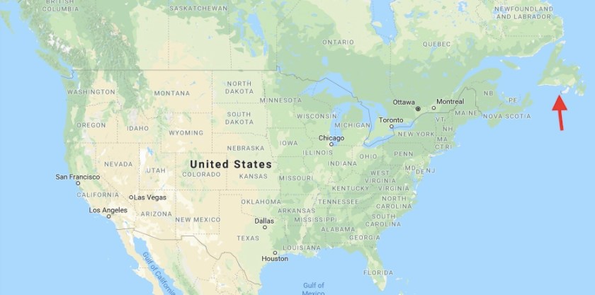
But I started looking at it on maps and doing a little research and my interest kept going up and up. Newfoundland is approximately 42,000 square miles, roughly the size of New York State, but has a population of only 525,000 people, 20% concentrated in the city of St. John’s, 51% on the Avalon Peninsula which is the chunk of land that makes up the eastern most part of the island. I figured it would be pretty wild and wooly which simultaneously intrigued me and scared me. I wondered if this place was the best place to be traveling in Greta. If something happened would I be able to find a mechanic to help?
The more I looked at maps the more I wanted to go. I encourage you to pull up Newfoundland in Google maps and check it out for yourself. You’ll see that the island’s coast is made of deeply cut coves and the island itself is pockmarked with water. It almost doesn’t look like solid land. My curiosity beat out my cautious side and I became obsessed with getting there.
As I drove off the ferry, and started driving up the Trans-Canada Highway, I was pleasantly surprised to find the weather sunnier and warmer than expected. The island has earned the nickname ‘The Rock’ and it seemed fitting based on my first impression. The landscape was rough and raw and barren and little houses dotted the hillsides surrounding the harbor.
From Channel Port-au-Basque I started making my way north along the western coast, passing by scrubby, rocky, rolling hills. The trees were contorted and small, an indication of the harsh conditions they had to contend with. Below is a picture that illustrates what most of the plants in Newfoundland have to work with: mere inches of top soil on top of rock. Plants must be real survivors to make it here.
 It’s common to see gardens plots just off the side of the road, where folks are cultivating the land. Not because they want to garden next to the road, but because that just might be the place where there’s actually enough topsoil to feasibly cultivate a garden.

I diverted off the main highway shortly after arriving to check out check out the Codroy Valley Peninsula and to walk Roo on the beach. I was surprised to find these magnificent vistas of the snow capped Long Range Mountains to my right and views of beaches and ocean cliffs to my left. It was stunning.


Along the way, I stumbled upon Chap’s Garage, a remarkable collection of memorabilia on display in a guy’s (I assume Chap) garage.


Driving around this peninsula loop, through little towns, it looked pretty rough and raw. Roads were in pretty bad shape. Towns were neat and tidy for the most part but no nonsense. Places seemed to be just coming out of the grip of winter and it was clear that winter was no picnic here.
I knew the surprisingly nice weather I was experiencing wasn’t going to last. Weather reports indicated a nasty storm was on the way and I decided I better get myself snuggled in to some accommodations up in the Gros Morne National Park area. No way was I planning on camping in the cold, rainy, windy weather that was supposed to arrive that night. So I just put the pedal to the metal and trucked up the Trans-Canada Highway as fast as I could.
I landed later that afternoon in this tiny little seaside town called Trout River. It was the closest town to two hikes that I had hoped to do while visiting Gros Morne so I figured best to be there so I could get out hiking as soon as weather improved. I was surprised at exactly how small and rough the town appeared when I rolled in. After I drive around town to scope it out, I almost decided to leave, I was so underwhelmed. But I’m glad I didn’t. The space I secured at a BnB was perfect. Clean, spacious, updated, and with a jacuzzi tub and along the water front street. It was perfect for weathering out the crummy weather.
I hiked up to the point on the north side of the cove that eve and then enjoyed a tasty seafood dinner at the Seaside Restaurant. It’s the one restaurant in town, a family owned operation that’s been around for decades, with a reputation for serving the best seafood in the area.

The weather rolled in that evening and the rain and wind started. When I took Roo out for her morning walk the next day I couldn’t believe how miserable it felt out. It was bone chilling cold and the wind was relentless. The crummy weather plus the stress of traveling for the past couple days caught up with me and I came down with a migraine. Roo and I basically spent that day in bed in Trout River, only going outside when absolutely necessary. When we did go out, I was cold and wet in no time and even Roo wanted to get back inside quickly.
The following day I woke up to find that the weather had improved vastly. Roo and hiked up to the lighthouse on the south side of the cove that morning and enjoyed beautiful views of the mountains and town.


After checking out of the BnB, Roo and I set out to hike the Green Gardens Trail in Gros Morne National Park. The guide books indicated it wasn’t the easiest of hikes so for the first time on the road trip I decided Roo should carry her own water in her doggy hiking pack I had brought along. Well, she wasn’t having any of that and I didn’t get more than 30 yards up the trail before I knew it was going to be a no go.

The hike took most of the day and Roo and I were absolutely snookered afterwards but it was worth it. What an amazing hike! The views up and down the coast from the top of the sea cliffs were incredible.


To my surprise, we ran into sheep on the trail and got chased by three mama sheep that didn’t like how close we were to the lambs. The dang little lambs were curious little creatures and actually came towards us. Three of the big ewes came out in formation and started to bum rush Roo and I. Of course Roo thought that was fantastic. I finally managed to drag myself and her across a little stream and that seemed to put a sufficient barrier between us and the sheep to satisfy the mama sheep.
After the hike, I made a quick stop in the cute lakeside town of Woody Point for some excellent fish and chips. As I drove out of town to hunt up a campsite, I just couldn’t believe the views. When I had driven in a couple of days ago, everything was socked in with clouds.

After a night at Berry Hill Campground, I drove a bit farther north in the park and stopped to take the boat tour of Western Brook Pond. ‘Pond’ has a very different meaning in Newfoundland as you can tell from the videos and pictures below. This boat tour was freaking amazing. An absolute must do if you ever get to Newfoundland.


From Western Brook Pond, I continued to push north up route 430 and stopped that afternoon to camp at Shallow Bay Beach, a lovely long crescent beach with views of snowcapped mountains as a backdrop. I saw no one else out on the beach when walking with Roo, other than a nice Newfoundlander out camping with his 4 yr old son for the night. After enjoying a nice sunset from the beach, I spent that evening sitting at the campfire with them, learning more about life in Newfoundland and getting tips on how to best experience the island.

Roo and I enjoyed another beach walk in the morning and again, we had the whole dang beach to ourselves. Just ridiculous.
Then it was back in the van to continue our push up the west coast. The drive north out of Gros Morne was very scenic. The mountains went on and on and the road traced right along the coast. Beautiful blue ocean to the left, snowcapped mountains to the right.

First stop of the day was Port au Choix National Historic Site. Port au Choix is known for the rare plants that grow only in the limestone barrens in the area and for the archaeological finds that cover at least 4 separate indigenous cultures.

From Port au Choix I continued north and stopped for a quick walk at Flowers Cove to check out the Thrombolites. These are the remnants of the first forms of life on earth.


As I drove farther north up the western peninsula the Labrador coastline became visible across the water and I started to see chunks of sea ice floating in the water. Roads got rough (and trust me, they had been no picnic so far) and I kept my eyes peeled for potholes as well as moose and caribou. The terrain turned into rocky, scrubby, rolling hills, dotted with small little ponds.
Finally, after two hours of driving, I arrived at Pestilot Bay Park for a night of camping. As I checked in for camping I inquired about the picture of a polar bear on the wall behind the desk and to my shock was informed that the last polar bear in the area had left just 7 days earlier to cross back to Labrador via the sea ice. What the what?? I had no idea that I was in polar bear range and that they might still be hanging around in June. As I drove to my campsite I could see that the campground still had quite a few patches of snow around. It was quite nippy out and I cranked the furnace in the van that night. I thought, if this is what the weather’s like in June, what is the winter like??
In the morning it was a fairly short drive to L’Anse aux Meadows National Historic Site which was one of the reasons I had made the trek up to the northern end of western Newfoundland. Declared a UNESCO world heritage sight in 1978, it’s the only identified Viking settlement in North America, dating back 1,000 years and it’s the first known evidence of Europeans in North America.
The tour given by the park ranger was fascinating. He had actually grown up there, his family’s house on the coast visible in the distance. He had played on the earthen mounds as a kid before anyone had identified them as the remains of a Viking village. His insights and stories of what life was like there were as fascinating to me as the history of the Vikings in the area. The park has done an admirable job of replicating buildings to represent what the Viking settlement might have looked like. The fact that the backdrop to all of this was beautiful blue water chock full of sea ice and icebergs made the experience all that more memorable.


From L’Anse aux Meadows I made my way to the town of St. Anthony and checked into a motel. Cold, windy, rainy weather was on the horizon again. While the news on TV talked of the first major heat wave hitting the U.S. and Canada, I was donning a layer of long underwear under my clothes…in June.
I was mainly in St. Anthony to find out more about the Grenfell Mission. My maternal grandfather volunteered here as a doctor in the 1930’s. My hope was that I might catch a glimpse of him in one of their photographs on display. Sadly I did not but I still found the displays fascinating and I learned a lot about what life was like in the late 1800’s, early 1900’s. Not easy to say the least. When Sir Wilfred Grenfell first came to Newfoundland in 1892, 30,000 people lived in Newfoundland and Labrador without medical or dental services of any kind. Life was pretty much subsistence living. Out of that, the Newfoundlanders have developed a very strong sense of community. It’s just par for the course that everyone looks out for each other and they are generous with what they have. Life is hard enough here and if you don’t band together with your community, life is just that much tougher. Roo and I went to check out the lighthouse in town before the weather got super nasty and found the waters around St. Anthony chock full of sea ice and icebergs.

Greta was in need of an oil change and the weather was nasty for traveling, so I decided to extend my visit in St. Anthony and take advantage of the fact that one of the few Newfoundland recommended mechanics listed on the roadhaus.com forum was in St. Anthony of all places. Maurice, the owner, came out of his office to chat with me because he didn’t recognize me and figured I must be from out of town. We had a great chat and it was a perfect example of the friendliness and hospitality that the Newfoundlanders are known for.
After Greta was checked out and I felt good that a major van issue wasn’t imminent, I made a last stop in St. Anthony to check out the Jodi Bonet tile mosaic in the rotunda of the hospital.


From St. Anthony, I decided to check out a town or two on the eastern side of the northwestern peninsula before making my way back down the way I had come. These roads were pretty remote and I was expecting to see some wildlife. I was not disappointed. Three caribou crossed right in front of Greta.

I made a turn towards the town of Conche and found myself driving on a gravel road. As it went on and on, I thought, what have I gotten myself into and considered bailing and turning around. But I pushed on and I’m glad I did. I came up and over hill to see the little town perched on the side of the bay, surrounded by blue waters speckled with icebergs. There was a French Shore Historical Center there that had a great exhibit on the history of the area and a 227 foot tapestry created to illustrate the history. It was quite something. Basque fisherman started coming for the rich cod fisheries sometime in the 1400’s, possibly the 1300’s. The world wondered where the Basque were getting all of the code that they were getting rich off of and eventually the secret got out and the French and English and Irish started coming as well, as early as the 1500’s. The result is that some areas of Newfoundland have deep connections with French culture and language, some to Ireland, some to England. From area to area in Newfoundland, the specific speech pattern, accent, and sayings were indicative of which European country dominated settlements in that area.
The folks that I met in town were SOOO nice and friendly and made sure I knew about all of the sites in the area and the hiking options. I really have to give Newfoundland credit for the availability of hiking trails. Pretty much every town has a trail of some sort. Hiking options abound. Roo and I did a hurried hike through the mossy forest along the top of sea cliffs before hitting the road.

I got back on the road and started driving as fast as I could (which wasn’t very fast) back down the western peninsula, hoping to make it to Norris Point in Gros Morne National Park.
I didn’t make it that far because I lost the light and wasn’t comfortable driving too far into dusk. Everyone was warning to stay off the roads between dusk and dawn because of the vast number of moose that come out during those hours. I had seen a couple of moose off to the side of the road and I definitely didn’t want to have a collision with one of those. They’re as big as Greta.
I did make time to pull into Arches Provincial Park for a very quick look as the sun was starting to set. Worth a stop.

I found a little boondocking spot in a gravel pull out at a overlook of the ocean and called it a night. Two other vehicles were doing the same. This was my first boondocking night in Newfoundland. (For those who aren’t familiar with the term boondocking, it essentially means to camp for free, ie, not in an established campground without any services.) Many travelers I had met were taking that approach and were a little mystified I wasn’t doing that myself. A police man in fact had told me it was fine to just park anyway for an evening. I figured, time to give it a shot.
My first boondocking night in Newfoundland was a success. Slept as sound as could be and I was hooked on the idea of not paying for camping anymore. Camping is surprisingly expensive actually. I estimated that if I camped for a month it would cost around $1000 at month. Double that if staying in private campground versus provincial parks.
I had another LONG day of driving to do as I was trying to get off the western coast and start covering some ground heading east. I stopped briefly in Norris Point to see what I had missed out on. I literally stayed for no more than 10 minutes and then moved on but man, what a view!

I picked up a hitchhiker as I was leaving Gros Morne. It was a guy that I had met on the tour of L’Anse aux Meadows a few days prior. I had seen him walking on the road up to L’Anse aux Meadows and when we got to chatting I learned that he had hitchhiked from Quebec! I was so hoping I was going to get a chance to give him a lift because we kind of got interrupted in our chat and didn’t cross paths again after the tour finished. So when I saw him on the side of the road with his thumb out I pulled right over. It was nice to have a company on the drive, even if just for a bit. We were sort of heading in different directions and I dropped him off within an hour. Roo loved having the company and sat on his lap the whole time. It was fascinating to hear about his adventures and how he negotiates his way around as a hitchhiker. Most of his rides had been provided by locals so he had had some wonderful conversations and really gotten some insight into life in Newfoundland.
After dropping off my hitchhiker friend in Deer Lake, the majority of that day’s drive was along the Trans-Canada Highway heading east towards St. John’s. It was sort of pretty but also quite boring and the drive that was supposed to take less than 5 hours felt like it took an eternity. My objective was the town of Twillingate, known for being a good place to see large icebergs and I was also planning on taking a whale watching tour.
By the time I arrived in Twillingate I was exhausted from the drive and hungry. When I coasted in to town I immediately started to get crabby. Compared to western Newfoundland, the place felt busy. Tourists were walking around, there were lots of BnBs and motels with ‘NO VACANCY’ signs up. I started to feel like an easy night of boondocking wasn’t in the cards.
I drove up to the lighthouse, thinking I might find a place to park it for the night there. Roo and I did some hiking around on the trails around the lighthouse and the views were amazing but unfortunately some jackass was flying a drone around which did nothing to improve my bad mood. For a few minutes I thought about bailing out of the Twillingate area.
I took a minute to collect myself and poked around a bit more and a turn out that I had blown by just down the road from the lighthouse turned out to be a wonderful boondocking spot right on the coast. WOO HOO!

I got Greta set up and then Roo and I (beer in hand) blazed off on the trails that traced the tops of the sea cliffs, out to one of the points, and settled in to watch the sunset. To my delight, I could see and hear minke whales in the water below.

After watching the sunset, Roo and I returned back to our camp spot to find that we had acquired a neighbor for the eve. Super nice and funny young guy, name of Matt, a Brit, driving around in his blue Volvo station wagon, dubbed Lucy, who had lived in Newfoundland for a bit and was out for a couple of weeks of road tripping around Newfoundland and Nova Scotia, testing out his vehicle and set up in preparation for a longer tour around Canada and the US.

Roo and Matt hit it off right away. He was missing his dog back home in the UK and was thrilled to get some pup time. We swapped travel tales and tips over beers that eve. I had to reflect on how my crabby mood had almost caused me to bail on Twillingate which would have been a shame. Another lesson on the importance of not getting upset and just hanging in there. Things seem to have a way of turning around for the good.
I realized part of my crabbiness that day had been due to the pace I was setting for my travels in Newfoundland. I had not allowed enough days. Newfoundland is huge, it’s got beautiful nooks and crannies, calling to me to be explored, and when weather turns to crap it gets really crappy so I had had a couple of unexpected down days that had thrown my itinerary off. I was trying too hard to cram everything in. The pace just wasn’t doing good things for my mood and state of mind.
I decided I needed a chill day and break from driving. I had seen these signs for the ferry to the Fogo Islands on my way up to Twillingate. Some quick Google searches piqued my interest. Population of just 3,000 people but a world famous inn and restaurant? Hmmm… I wondered what that was all about. I made a snap decision to cut my time in Twillingate short, cancel my boat tour, and catch a ferry to the Fogo Islands the following day to do a little hiking and hanging out on the beach.
As I drove to catch the Fogo Island ferry the following morning it started to rain, hard. I thought, what the heck am I doing? Is this a good idea? Matt pulled up at the end of the ferry line. He decided to risk the rain and give the islands a try to. When we got to Fogo Island it was still raining but we decided to try for a hike called the Lion’s Den and by the time we had parked and started walking the trail the rain had stopped and the sky was lightening. The sun came out not too much later and the scenery was truly truly gorgeous.

After the hike, we headed to Sandy Cove over by the town of Tilting, and found a beach side park to boondock it for the evening.
The town of Tilting was freaking cute as hell. Little fishing shacks dotted the shoreline and perched out on rocks in the water.

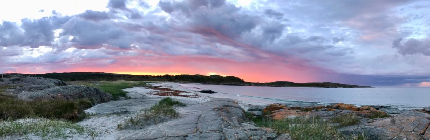
We drove back into town to see if we could find fish and chips. On a recommendation we popped in to the The Scoff restaurant and were delighted to find a creative and fun menu, farm to table style, with some really good vegetable dishes. Yeah! Vegetables! My eating out options had pretty much consisted of fried fish or burgers, perhaps some moose stew. Western Newfoundland isn’t strong on cuisine options. The menu at The Scoff was a very welcome change of pace. After a delicious dinner, it was back to the beach for a chill evening. Entertainment that eve was playing with Roo on the beach and then watching this fantastic storm system move through just to the west, making for a dramatic sunset.
A second storm system moved in, but this time passing directly overhead. The rain started coming down hard and Matt and I dove into our vehicles to hunker down for the evening.
The rain had stopped in the morning but it was gray and chilly. I packed up Greta, and went over to the Fogo Island Inn for a tour of this famous inn that I had read about. From afar I was surprised at how big it looked and how jarring it was on the horizon. It looked like an iceberg or ship.

A couple of locals I spoke to weren’t keen on the aesthetics. An eye sore as they put it. But after touring and seeing the place up close and from the inside, I came to like it quite a bit.


It was very interesting. Simple and minimal architectural approach but warm and cozy. Quite a place, with a lot of thought given to construction and supporting the community and to education. For example, the movie theater shows films and documentaries on the culture and history of Newfoundland. There’s been a huge effort to source as much possible materials and labor locally.
I wish I could afford to stay there sometime. Unlikely as it’s $1500 – $2000 per night. OUCH! But honestly after seeing the facilities and seeing what they offer as experiences during a stay, I don’t think I’d feel like I overpaid at all.
After touring the inn and before queuing up for the return ferry, I decided to cram in a quick hike to see one of the 4 artist-in-residence studios on the island. The studios were designed by the same architect as the Fogo Island Inn.

Man I liked Fogo Islands. I would loved to stay for another night or two. Oddly, I saw three other VW Westfalias while on Fogo Island. I hadn’t seen many of them lately and I thought it so odd that Fogo Island is where they’d reappear.
After disembarking from the ferry, I was back to boring driving along the Trans-Canada Highway. I pulled up in Terra Nova National Park to camp for a night. I had finally hit the point where I couldn’t go another day without washing my hair. I thought my shorter hair might just look kind of punk rock and sassy after a few days without washing it but nope, it just looks dirty and bad crazy.
The bugs were awful in the campground at Terra Nova, the worst being the biting black flies. I couldn’t take it and hopped in the van and headed down to Sandy Cove beach, just a little ways down the road from the campground. As I hoped, there was a breeze down at the beach and it kept the bugs away. Roo and I poked around down at the beach until sunset and only when it was really finally getting truly dark did I head back to the campground to park it for the eve.

I awoke to an absolutely beautiful sunny and breezy day . I fit in a short hike with Roo to a viewpoint with an amazing overlook of the surrounding area before hitting the road again.
I was back on the road, intending to loop around the Bonavista Peninsula that day. It was to be another long day of driving and there wasn’t any room for much dilly dallying along the way. The drive up the west coast of the peninsula was much more scenic than I had expected. Large expansive views of the Bonavista Bay, plunging cliffs, icebergs in the distance. I rolled into the town of Bonavista, not expecting much, and found it quite charming. I was starving and The Boreal Diner caught my eye. Oh man, what a nice find! Excellent, interesting food, celebrating farm to table.
After lunch I drove north out of town to go check out the lighthouse at the end of the peninsula and found stunning views with humpback and minke whales and icebergs in the surrounding waters. It was absolutely gorgeous and I decided then and there that my plans for the day had to get thrown out the window. There was just no way I was hurrying through the Bonavista area… it was too pretty and interesting to rush.
I got on the phone and was able to push my ferry departure from Newfoundland out two days. Woo hoo! That gave me a little more wiggle room and I could slow down my pace. I set out to explore the Bonavista area further.

From the lighthouse, I headed over to Dungeon Rocks Provincial Park for more stunning scenery and to check out a collapsed sea cave.


Then a quick drive over to the Elliston. I stopped into the visitor center and had a fantastic chat with the two guys inside. One told me an inspiring story. Like much of Newfoundland, the main industry in Elliston had been cod fishing until a moratorium went into place in the 90’s. With the shut down of the cod fishing industry, communities plunged into really rough times. Many people ended up on unemployment and many people ended up having to move away. Communities were on the brink of collapse. The town of Elliston didn’t have enough tax revenue to cover basic infrastructure needs and the power company came in and shut off the street lights. When this happened, the community said enough is enough and rallied. The community organized and started a successful tourism industry. Historic houses are being renovated, interesting restaurants are starting to open. Visitor numbers are increasing year after year. “From the dark came the light” is how this gentleman put it and I could sense the pride he had for how his community had come together during tough times.
After my lovely visit with the guys at the visitor center, I toured around the town to check out root cellars and the puffins. Elliston claims to be the root cellar capital of the world and they just might be.

They have quite a few and you can actually go into some of them if you like. I did. It was dark and cool and I got freaked out and boogied back out.


Then I went to see the puffins which is what Elliston is really known for. This was just amazing. You can walk out the edge of a cliff and just across is a rock where thousands of puffins were nesting.

They are just the cutest, clumsiest birds. Like potatoes with wings as someone described them. I sat for quite some time watching them with my binoculars. It was quite amusing to watch them take flight and negotiate their way down from the top of the rock to the water below. Not graceful in one bit. When I turned around to glance at the other people enjoying the same view, I realized we were all sporting the same goofy, silly grins.
After taking in the sights in the Bonavista area, I decided to make some progress down the east side of the peninsula before calling it a night. I made it to Port Rexton, intending to boondock for the evening and hike the Skewirk Trail first thing the following morning. It’s supposed to be one of the top 25 hikes in North America. I figured I better not pass that by without checking it out.
Before trying to find a camping spot for the night I popped into Port Rexton Brewing for beer and dinner. It was a fun scene and folks were super friendly. I felt like I was in Portland. Fun vibe, everyone hanging out and having a good time.
From the brewery I set off to try to find a place to boondock it for the evening and it was a little trickier than I had hoped. Places recommended by some locals had signs indicating ‘no overnight parking/camping’, first of those types of signs I had seen so far in Newfoundland. The signs looked pretty new. Dang it.
A search on freecampsites.net (good resource for travelers to Newfoundland) turned up a possible spot in the area. A short drive out a gravel road on government property led to an open gravel lot off the side of the road that would do just fine for the evening. A fox came to see what we were up to.

The wind was really blowing hard and I didn’t dare pop the camper top for fear of damage. Even without the top up, Greta was getting buffeted around by the wind and as I fell asleep that night I felt like I was on a boat out on the water.
I woke to find that the nice weather from the day before had evaporated. It was cold, gray and foggy. I headed off to tackle the Skerwink Trail. Man, I wish I had knocked it out the day before when it was clear. The hiking trails traces through the forest, along the edge of dramatic sea cliffs. It’s litterally just feet away from the edge in places.


I’m sure the views would be stunning on a nice day. But the weather wasn’t the best and I had fuzzy views of rock formations obscured by fog. Roo and I enjoyed it nonetheless, especially the little play time on the beach at the end.


I had built up an appetite and after the hike I went to try the Two Whales Coffee Shop in town. YUM! Great coffee and healthy, delicious, inventive vegetarian fare.
From Port Rexton, I headed south to the picturesque, historic town of Trinity. Roo and I enjoyed a stroll around the town, checking out the historic homes and church. Definitely worth a stop.


From Trinity I pushed on for a few hours of driving, through some miserable and heavy rain, to arrive in Heart’s Content later that afternoon. I had made my way here so that I could do some research on family history. My dad’s family hails from this town, by way of England, and I apparently had relatives in the area.
I had a couple of names, no phone numbers or addresses. I rolled in to find a small, pretty, tidy little town on the edge of a bay. I stopped in for a bite at the restaurant in town and when I asked after the two people I had names for I was directed to one’s house and told the other was away and out of town. How’s that for a small town?!
I went over and knocked on the door of my ‘cousin’ and was invited in. The surprised look on his face when I told him that we shared the same great great grandfather was priceless. He hopped in his car and directed me to the cemetery in town where I might find some gravestones. Unfortunately the church had burned down in the 90’s and records with it and the cemetery had fallen into bad disrepair. Sadly I wasn’t able to find any headstones that aligned with my family tree.
I enjoyed a quiet evening of boondocking out at the lighthouse and listening to minke whales in the bay.

The following day I decided to check out the Heart’s Content Cable Station. This town was the western terminus of the first Transatlantic telegraph cable. The equipment used is preserved and on display and it was fascinating lesson on the early days of telecommunications.


From Heart’s Content, I drove a bit north to check out the wooden boat museum in Winterton. It was a really good exhibit covering the history of wooden boat building in Newfoundland, with examples of some of the different types and designs. It also provided information on the history of the fishing in the area and how advancements (such as the outboard motor) had influenced the designs and types of boats used on the island.
It looked like another nasty weather system was blowing in so I decided I better high tail it over to the St. John’s area and find a Airbnb spot to snuggle down in during the nasty weather. I hit the jack pot and found myself staying in the guest’s quarters of a couple’s house in the town of Bauline, northwest of St. John’s. Their house was right on a little lake and Roo and I had a nice down day while riding out the storm.
While Greta was parked in the wet driveway, it became clear that Greta had an oil leak as a shiny patch slowly surrounded the ground around the van. My hosts were concerned and got me connected with a mechanic in the area and actually came along for the check up. Yep, an oil leak but minor and something that could wait for permanent repair until I got back to the Seattle area.
I headed out to spend a couple of nights in the St. John’s area. I had a list of things to explore in the St. John’s area based on recommendations from folks I had crossed paths with in my travels and I set out checking things off the list.
First stop was to check out The Rooms, an archive, art gallery, and museum celebrating the history and culture of Newfoundland. It was pretty amazing and I recommend that you fit it in if you ever visit St. John’s. It’s a location where they hold ceremonies to swear in new Canadian citizens and watching that day’s ceremony ended up on my list of favorite Newfoundland experiences. It was very moving.
I headed over to check out Quidi Vidi, a little neighborhood of St. John’s crammed around Quidi Vidi Lake.

Had to stop for a tasting flight at Quidi Vidi Brewing Company. Delicious and great location!

Out back I found some ducks enjoying the left overs of the brewing process. One appeared to be keeping a look out while the other gorged on left overs.

It was great being back in a town where a good latte was easy to find. Mornings started off with either a visit to Fixed Coffee & Baking or The Battery Cafe. or perhaps both.


Signal Hill is a popular place for hiking and the views of St. John and the harbor and sea can not be beat!


Up at Signal Hill is the Johnson Geo Centre, a geological interpretation center with exhibits explaining the geological history and features of Newfoundland and Labrador. It was way cool and it would have been really nice to have visited before I toured the island.

On June 29th, I went to do a zodiac boat tour of the Witless Bay ecological reserve. Wow! This was amazing! There were only 5 of us on the boat. Hundreds of thousands of birds nest on the little islands just off the coast and we were literally surrounded by birds. I can’t believe we all didn’t come back covered head to toe in bird poop. Our guide did suggest that we kept our mouths closed when looking up. Ha ha.

This video shows the ‘single scene’ of the puffins world. The puffins looking for mates are the ones hanging out on the bare rock. Ones that have found a mate are nesting up in the grass.
On the boat tour, I met a woman from Calgary out traveling on her own and we decided to do a little hiking after the boat tour to the ruins of the town of La Manche, originally settled in 1840’s and abandoned in 1966 after a storm surge during a wicked winter storm demolished the majority of the town’s infrastructure. A newly constructed suspension bridge, connecting sections of Newfoundland’s famous East Coast Trail, spans the narrow gorge where the town used to be.

Later that eve, I went out hoping to find some live music. St. John’s is known for a being a music town. George Street is the place to go according to tour books but talking to locals, it didn’t sound like my scene. It has a reputation for being a bit of a drunk fest. So instead I spent some time drinking beers at The Ship Pub and The Black Sheep Pub, favs of locals. I caught a good music night at The Black Sheep featuring two singer song writers that had some hilarious material, my favorite being the ‘instructional reggae’ tune on cod fishing and a tune, Joe Batt’s Arm Tarts, about some bad-ass, dart playing ladies that can’t be beat from the town of Joe Batt’s Arm, which I had actually recently visited when up on Fogo Island.

About a 20 minute drive from St. John’s is Cape Spear National Historic Site. From the lighthouse, the spouts of whales were visible off in the distance. This is the eastern most point of North America and it felt kind of cool to put that on the list of ‘accomplishments’ for the road trip.

Before I left St. John’s I had to check out the MUN Botanical Gardens, the highlight being catching a bed of Himalayan poppies in full bloom. Oh, that electric blue is to die for!


After my few nights in the St. John’s area, I pushed off to do a tour of the Grand Colinet Island peninsula before catching the ferry back to Nova Scotia. First stop was the Salmonier Nature Park, an environmental wildlife and rehabilitation center. A boardwalk takes visitors through exhibits where you can view animals. The animals in these enclosures, open to public viewing, are animals that have been deemed unable to be returned to the wild. Other wildlife that is actively being prepared for return to the wild were kept in separate enclosures, away from people. It was a pretty neat way to see some animals up close. The female Canada lynx was out and that apparently is pretty rare.


After the nature park tour, I kept driving south down the peninsula and had expected a pretty boring drive. Folks had kept saying, oh it’s just barrens down there. Well, yea, it was barrens but I found it just gorgeous. Views and views of the wild barrens. I was hoping to catch a glimpse of the herds of caribou that roam down in that area but unfortunately I did not.
I made it to the Cape St. Mary’s Ecological Reserve. This was such a cool stop and worth the effort it took to get there. There are tens of thousands of birds that call this home during the breeding season. A hike goes out to the edge of the sea cliffs just across from Bird Rock with amazing views of the nesting birds.

It was actually terrifying for me to be out there. You literally stand on the edge of a cliff and one wrong step, you take a fall long enough to have a moment or two to contemplate your death. Unsettling. I sat for a while taking in the views and my fear of heights eventually got the better of me. Rather than getting more comfortable, my sense of vertigo and nausea got worse and worse and finally I gave up and moved back up the trail until I my knees stopped shaking.
I found a great boondocking spot just off the road leading into the reserve. We roamed the surrounding fields and Roo romped along the burbling brook and it was a really nice quiet spot to spend our last evening in Newfoundland.


It was July 2nd, 3 weeks since I had arrived on the other side of the island, and it was now time to catch the ferry back to Nova Scotia. I drove up the coast to Argentia and the ferry pushed out that afternoon heading back to Sydney, Nova Scotia. From Argentia the crossing takes 16 hours! I got Roo tucked into the kennel area and my stuff settled into my sleeping birth and then I went out on deck for my last views of Newfoundland.


I have to admit that I actually teared up a bit as I took my last look at Newfoundland. Newfoundland is one of my favorite places I’ve ever had the pleasure to visit and despite touring around for a full 3 weeks, I still felt like there was more I wanted to see and experience. And the people… so nice and friendly and hospitable. I encourage everyone who has a hankering for wild and woolly places to put Newfoundland on your travel bucket list.

Great Trip report. You and Roo experienced a lot, and Greta did not dissappoint. Ancestors, scenic sights, icebergs, whales, trails, birds and brews…..and VIKINGS!!! Thanks for sharing. It takes a lot of time and effort to share with your followers. Looking forward to your cross across Canada.
LikeLike
Thanks so much! I hope your road trip preparations are going well.
LikeLike
Wow, you really saw a lot in a short time. I am so glad that you decided to go.
LikeLike