Well, I’m way behind on keeping up on blog posts. Turning out to be not so good at this blogging thing. Anyway…
My goal had been to at least make it to my parents’ house in Aiken, SC in time for Thanksgiving and I managed to do that, rolling into town on 11/20. December was spent hanging out with family, taking little side trips and taking a nice break from the road.
Aiken is a neat little town. Quaint, historic and with a rich tradition in horses.
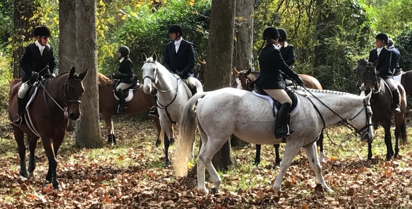
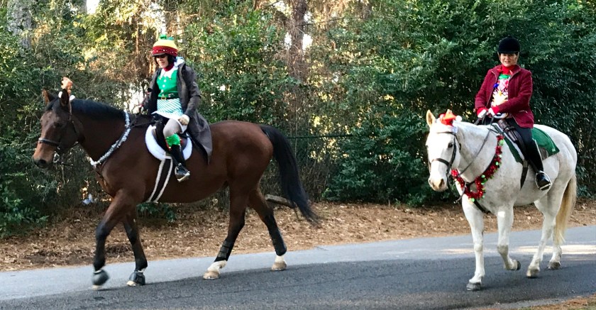
My mom on Gresham, far left at the Thanksgiving Day hunt.
Both Roo and I were VERY happy to be taking a break from van life and it was good to stay put and get into a regular daily routine again.
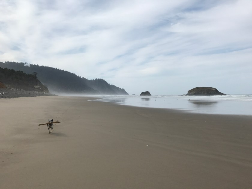
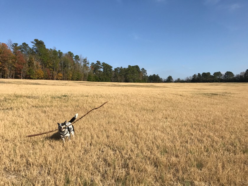
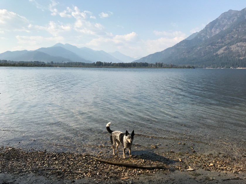
Roo on one of our daily walks thru the fields. Best part of out day!
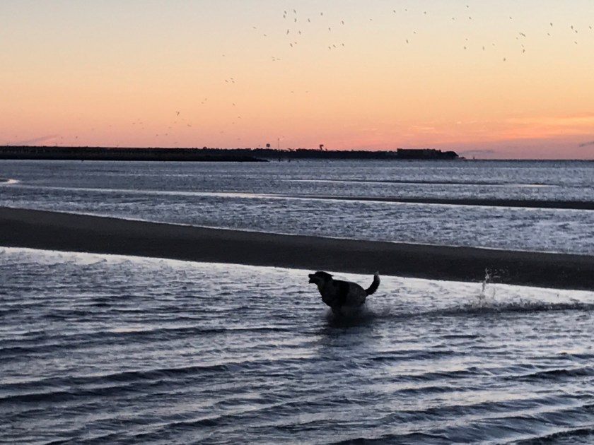
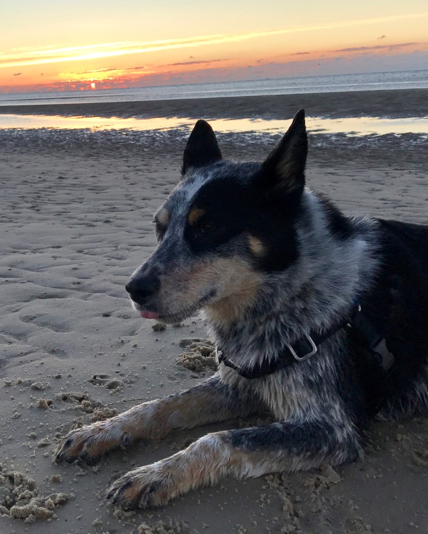
Early December, I went off to visit friends on Kiawah Island for a few days. Mornings started with a sunrise romp on the beach with Roo. Evenings ended with a sunset romp on the beach with Roo. During the days we tooled around the island or explored Charleston. Kicking it with friends was fantastic and Kiawah Island during off season was amazing. Felt like we had the place to ourselves at times.
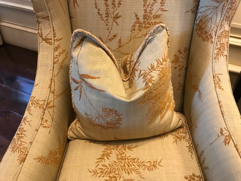
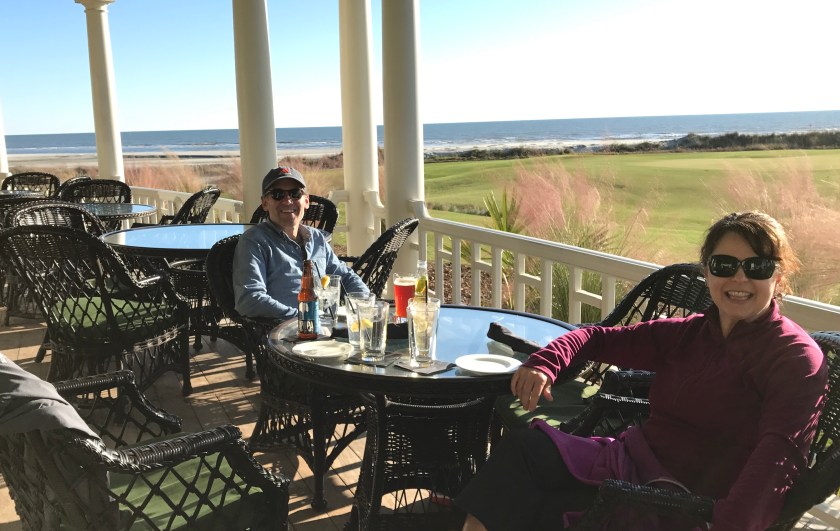
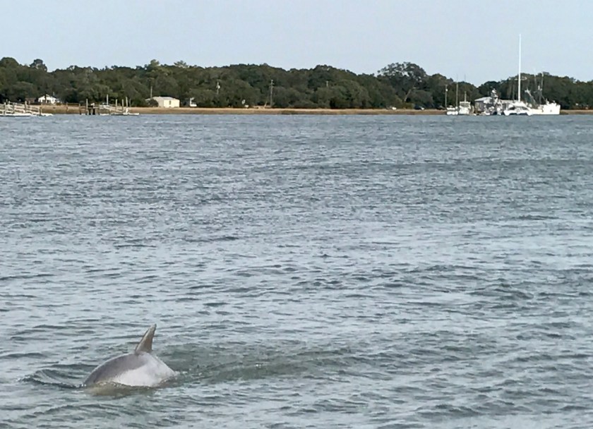
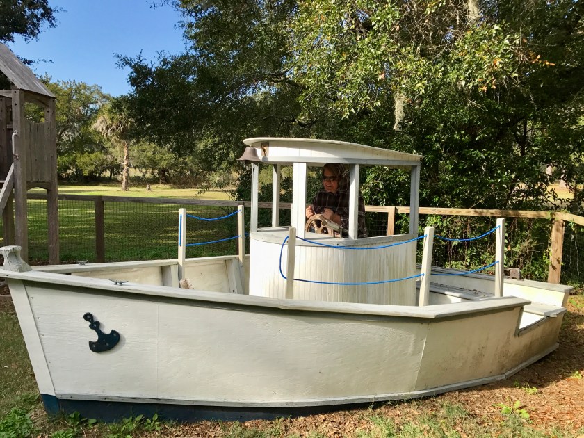
Sunrise on Kiawah IslandMasterful pillow chopping technique at the Sanctuary Hotel. Yea…pillow chopping is a real thing.Gators on the golf course – look out!Drinks overlooking the Ocean Course on Kiawah Island.Looking for sleeping cleaning people in the restroom closet at the Ryder Cup Bar. (Long story…)Dolphin off Wadmalaw Island – woo HOO!Mossy oak trees towering over Fellowship Hall in Rockville, SC on Wadmalaw Island.Dreaming of becoming a shrimp boat captain on Wadmalaw Island.
After Kiawah Island I returned to Aiken for the remainder of the holidays. This was the first Christmas I’d spent with my parents since they’d retired to South Carolina.
The Christmas Hunt. My mom on Gresham, left, and Julie and Munchie, right.
It was great fun to see the vast Christmas decorations collection my parents have accumulated on display. It takes weeks to get them all up and then take them all down.
The rents with a fraction of the Christmas decorations.
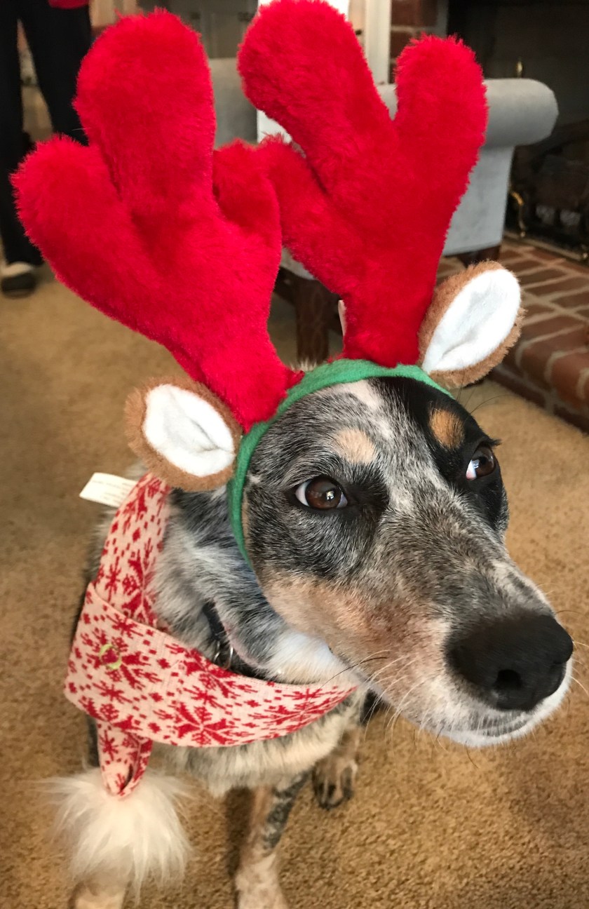
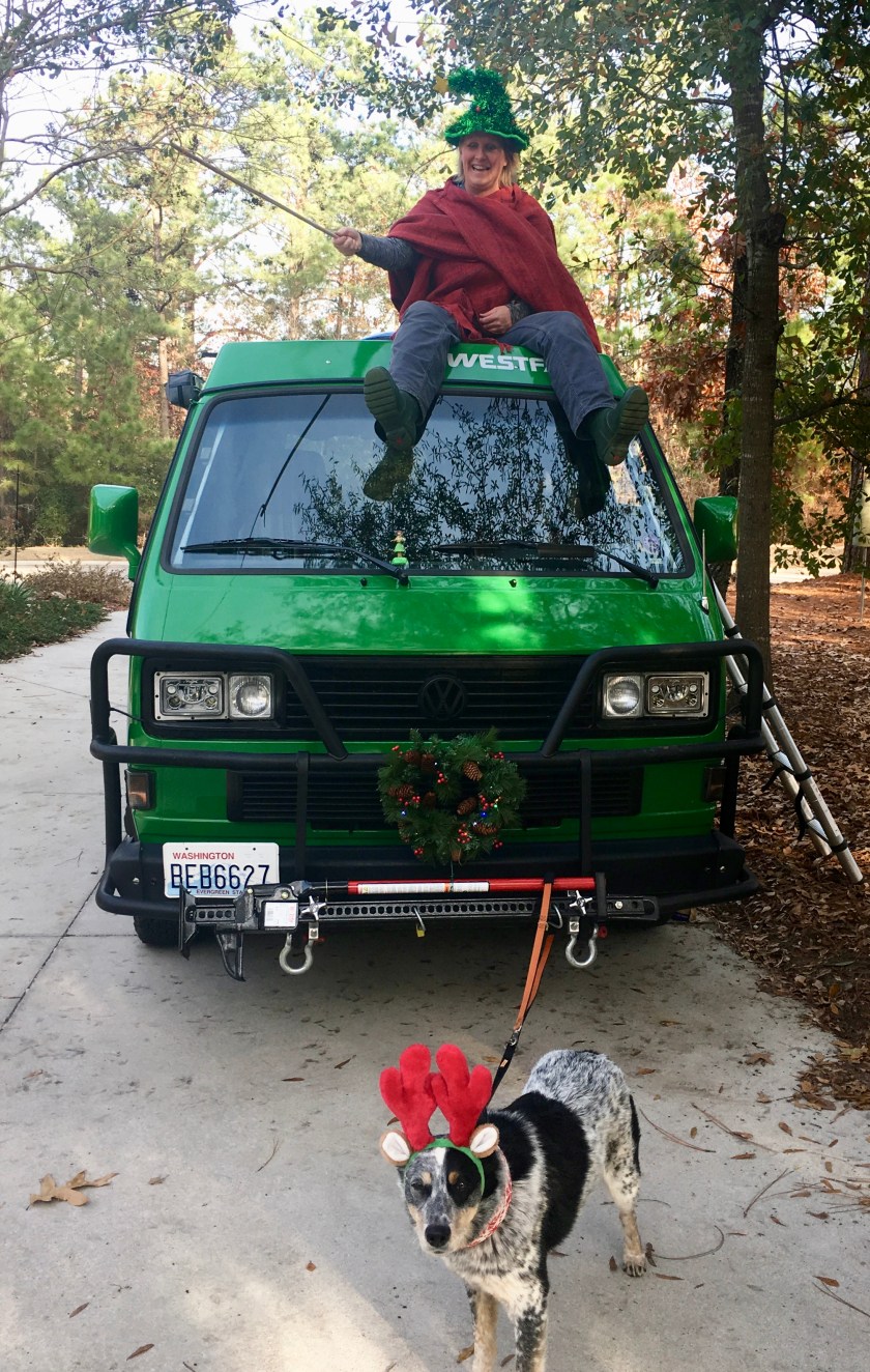
Poor Roo got caught up in holiday shenanigans.
ROOdolphRoo as Max in our rendition of the Grinch.Roo is pretty sure I just received the best Christmas present ever.
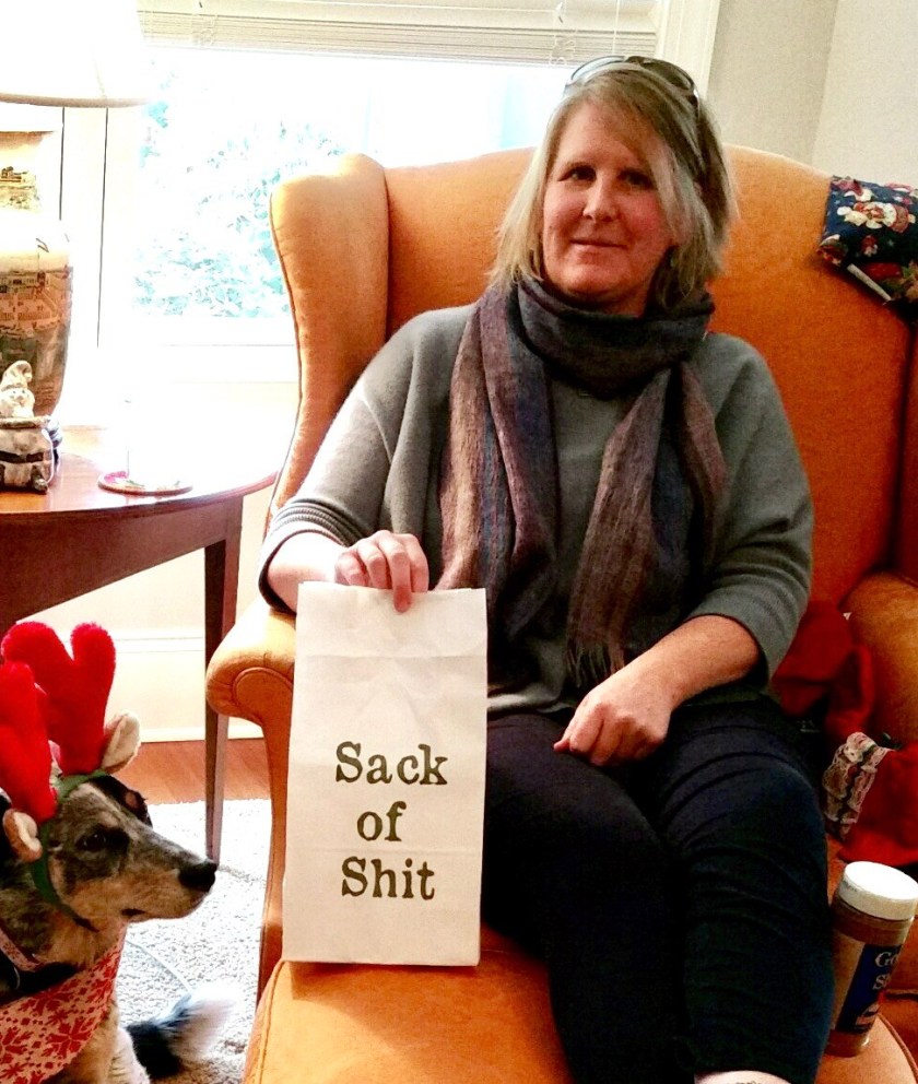
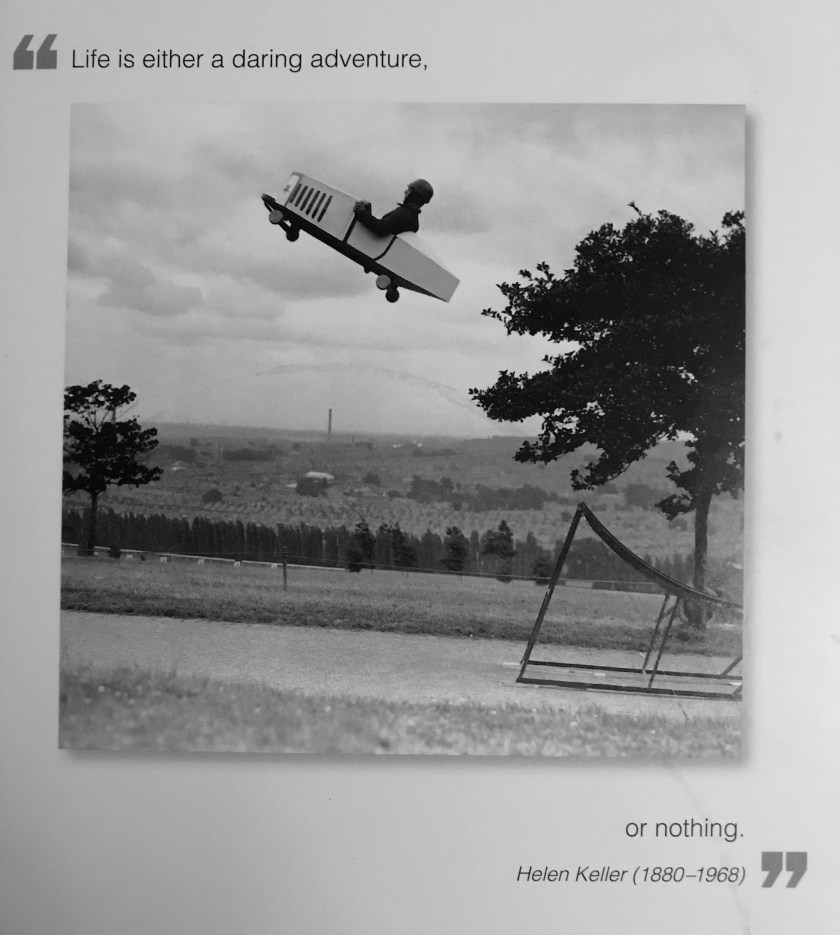
As the holidays and year came to a close I was feeling a little antsy and on New Year’s Day I opened a card from my aunt and got a good reminder of what this whole road trip is about.
Word up, Helen.
I packed up the van and set out on January 2nd, heading south towards Florida, hoping to find some warm, sunny weather. More on that soon.
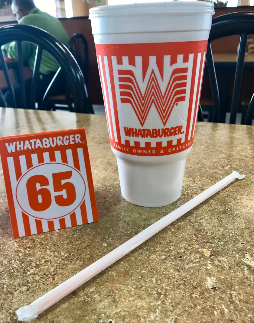
Wednesday, November 8th I crossed the New Mexico/Texas border around lunch time and popped into El Paso, TX to try a burger chain I was unfamiliar with, ‘Whataburger’. Seemed very stereotypical Texas to order a small coke and get a 32 oz cup. WTF Whataburger??
My “small” coke – a mere 32 oz.
Shortly outside of El Paso I hit a border patrol check along the highway that all eastbound traffic had to pass through. Answering “yes” to “Are you a US citizen?” was all it took to be waved through.
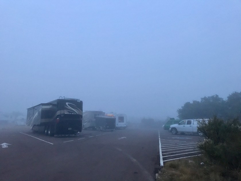
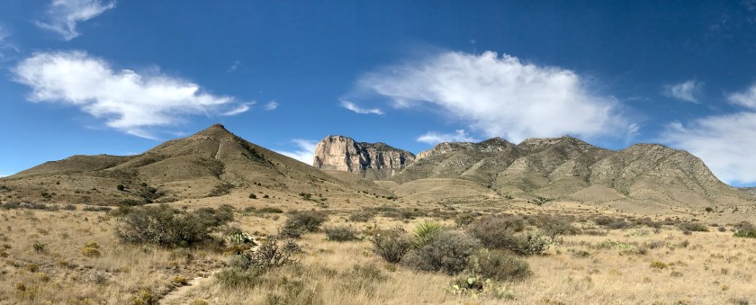
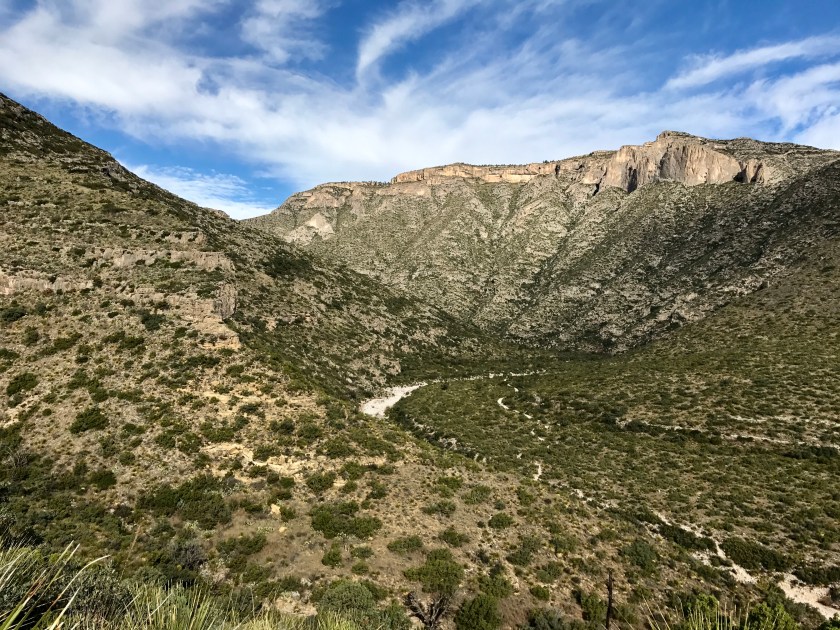
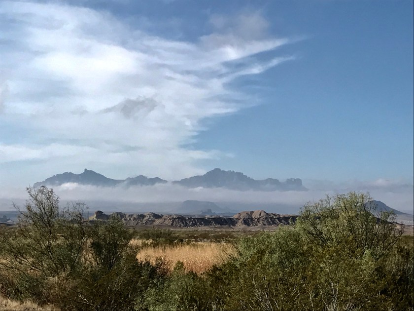
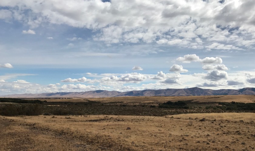
I was bound for Guadalupe National Park which contains the highest point in Texas, Guadalupe Peak, at 8,748 feet and the drive east out of El Paso was beautiful. I drove across the plains with mountains of all shapes and sizes rimming the horizon. As I approached the park the road started to climb in elevation and soon the road plunged into a cloud bank and driving got scary. Visibility was poor and as the road twisted and turned up into the mountains I had that feeling of losing sense of what’s up and what’s down. I crept along with my hazards blinking, hoping not to go off the road, praying I wouldn’t get smashed into by some idiot driving way too fast. I was SO relieved when I arrived at the park and found my way the campground.
I chatted with a fellow camper and apparently the thick fog had rolled in the night before and had blanketed the park all day. Well, this wasn’t what I had expected. It was kind of cool to be inside of the clouds and to stroll through the roiling mist. It was quite moist, everything wet to the touch. The thick cloud cover gave the place a mysterious, otherworldly feel but I did hope that the morning would bring better weather so I could at least get a glimpse of the mountains before I pushed off. And I really didn’t want to drive in the thick stuff again.
BEFORE – Fog at the campground in Guadalupe National Park when I arrived.
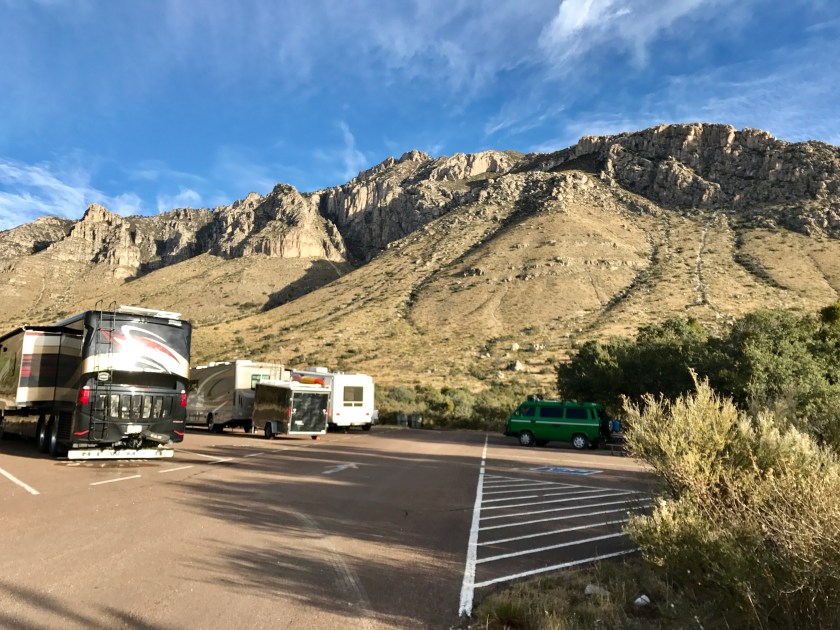
Thursday, November 9th I woke to a beautifully clear day and to find the mountains right there outside of the van. WOW!
AFTER – No more fog!
Roo and I did some hiking and I geeked out over the unfamiliar plant palette and scenery and checked out the ruins of an old stage coach stop that predated the Pony Express. Much of the mountain range is formed from an ancient coral reef that used to lie under a shallow sea that covered the area approximately 250 million years ago. How freaking cool is that!
From Guadalupe National Park I headed southeast bound for Marfa, TX. Along the way I stopped off at Davis Mountains State Park and Roo and I hiked around for a bit, enjoying the beautiful day and views.
Hiking the Skyline Trail at Davis Mountains State Park.
After Davis Mountains State Park, I continued the drive south towards Marfa, but made a stop to poke around the Fort Davis National Historic Site, a frontier military post that operated from 1854 to 1891. They have many well preserved barracks and a collection of old artifacts like cavalry, military, hospital and kitchen equipment that provide a good glimpse back into life during that time.
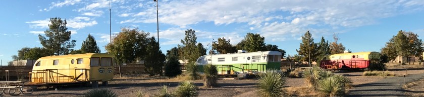
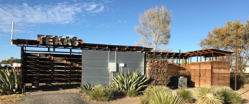
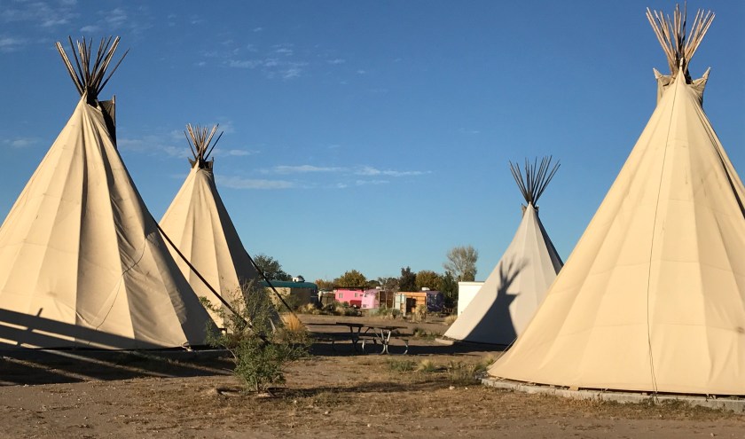
From Fort Davis, I made my way to Marfa, TX and rolled into El Cosmico, a funky campground/RV park with refurbished vintage trailers, teepees, and safari tents to rent as well as sites to set up your tent and park your RV/camper. Unfortunately their RV/camper sites were essentially in the parking lot on the outside of the fence and it made me a feel bit isolated. But once I realized that El Cosmico is a magnet for wanna be hipsters I didn’t mind being slightly removed. It was like being at a zoo featuring free roaming, beard bearing, skinny jean wearing hipsters.
Refurbished vintage trailers available as overnight accommodations at El Cosmico in Marfa, TXThe bathhouse at El Cosmico.Sleep in teepee.
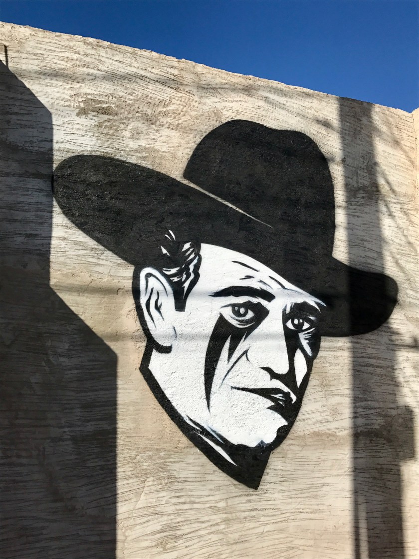
Friday, November 10th I spent poking around Marfa, sniffing around, trying to get a bead on the place. It’s a funky, sleepy little town, now known as an art hub. If you don’t know where to look or to go you could easily pass through the town without blinking an eye. A little patient poking around leads to fun discoveries and encounters.
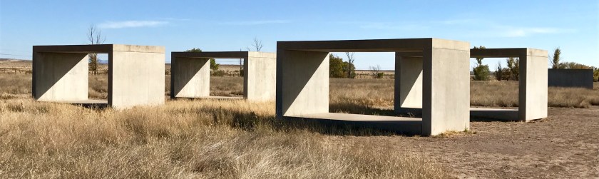
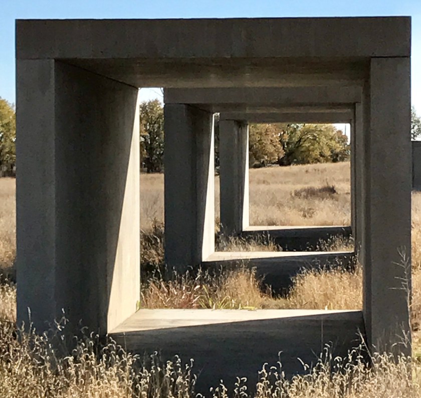
The Chinati Foundation is the anchor of the Marfa arts scene. Unfortunately I hadn’t planned ahead and was unable to get a reservation for a guided tour of the full collection. But I did tour the concrete and milled aluminum pieces of Donald Judd’s and Robert Irwin’s untitled dawn to dusk installation.
Donald Judd’s concrete pieces
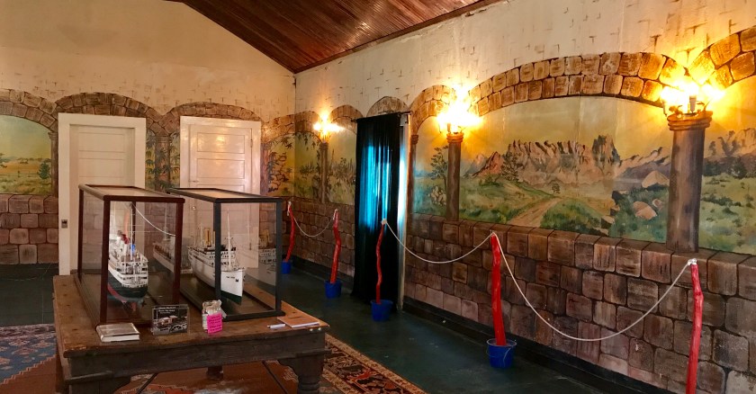
I popped into Building 98 to see the wall murals that had been painted by German POW’s held in Marfa during World II.
The day ended at the beer garden at Planet Marfa, where I enjoyed good beer and nachos and a chat with one of the owners about the town. Like many places that start out as havens for artists (which generally means inexpensive cost of living) the town was becoming more popular and well known and as a result more expensive and less affordable for artists and locals.
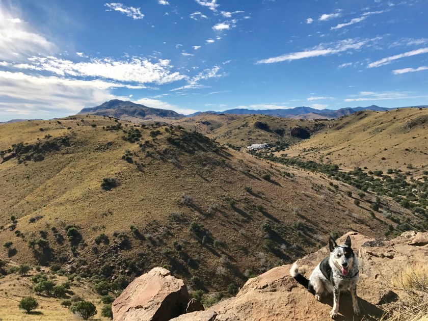
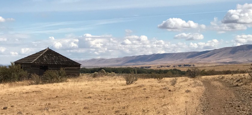
Saturday, November 11th, I was making my way out of town in the morning, bound for a night of camping in Big Bend State Park, and I remembered I needed to buy more propane if I wanted a warm meal for dinner and, most importantly, coffee in the morning. I pulled over to check google maps for the closest hardware store. As I was about to pull away from the curb I looked over to see a man trotting towards the van waving his arms with a huge grin on his face. He was a VW collector and enthusiast and super excited about Greta. We chatted and I learned that he practices the craft of building with adobe, a dying trade and something that had greatly piqued my interest since encountering the beautiful adobe buildings of Santa Fe. He generously offered to show me an adobe structure project out in the desert later that afternoon. I couldn’t pass up that opportunity. It meant I’d arrive at Big Bend State Park much later than I had originally planned but these kind of fortuitous meetings with people are the gems of road trips and I had to see where this would lead.
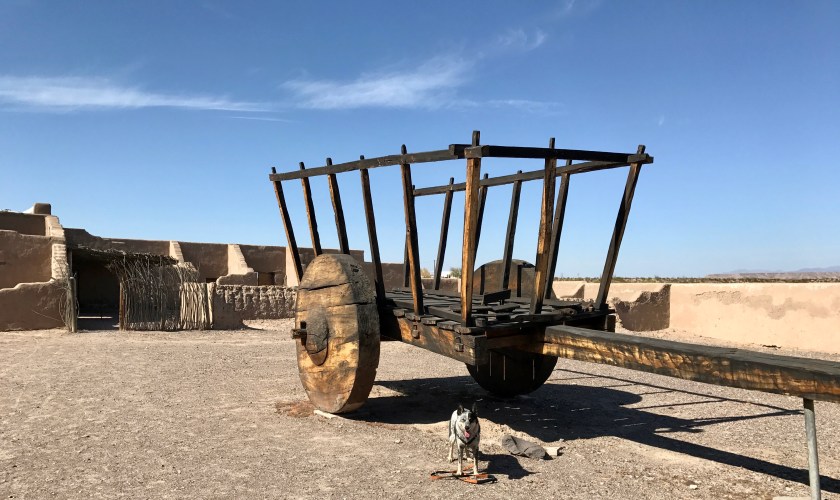
While I waited to meet up with my new VW friend later that day, he suggested I check out Fort Leaton State Historic Site, an excellent example of traditional adobe building.
Fort Leaton, TXFort Leaton, TX
While touring the fort, Roo and I stumbled upon a gigantic wagon and I had to ask a park ranger if it was true to size and how one of these devices had been used. He indicated in fact that they were often even larger, with 12′ foot tall sides and pulled by teams of oxen. Holy hell, that must have been quite a feat to navigate thru the scrubby desert plains.
Later that afternoon I met up with my VW friend and headed out to check out the adobe structure. The views across the plains to the mountains of Chihuahua, Mexico were spectacular!
Seeing an adobe structure up close with someone who practices the craft to explain the process was fantastic. The buildings are not in great shape as they have not been maintained properly over time but it did provide an opportunity to see the various layers of building materials used in the process.
I was reluctant to leave this magical setting but the sun was starting to sink in the sky and I had to push on if I was going to make it to my campsite in Big Bend State Park before I lost daylight.
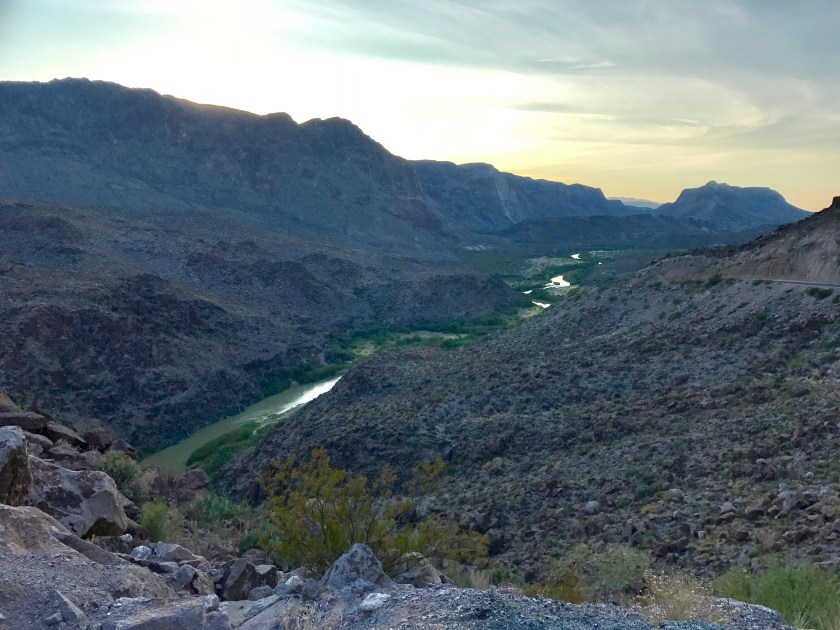
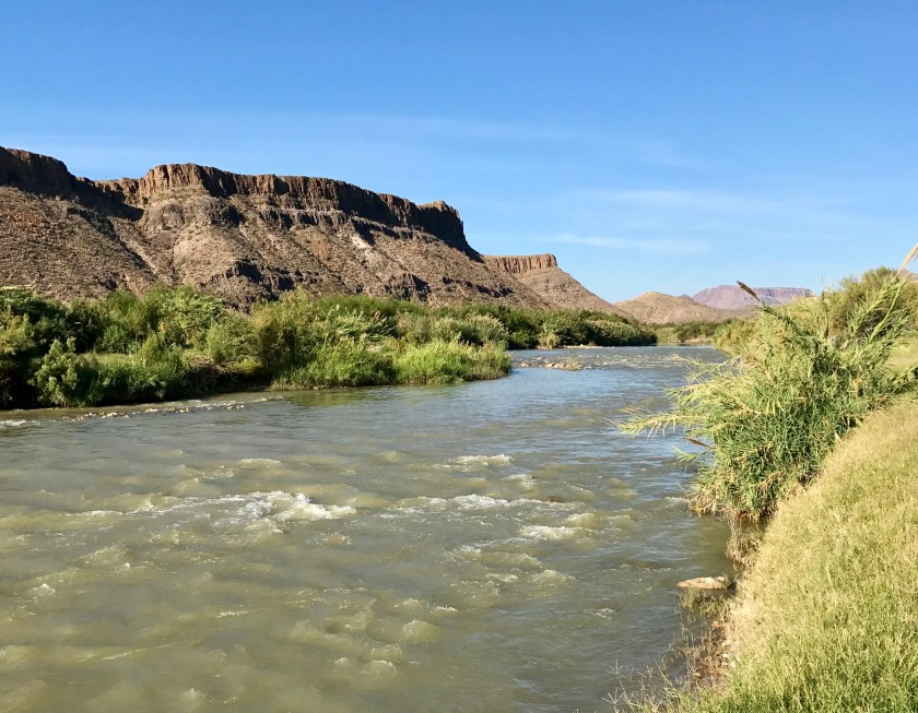
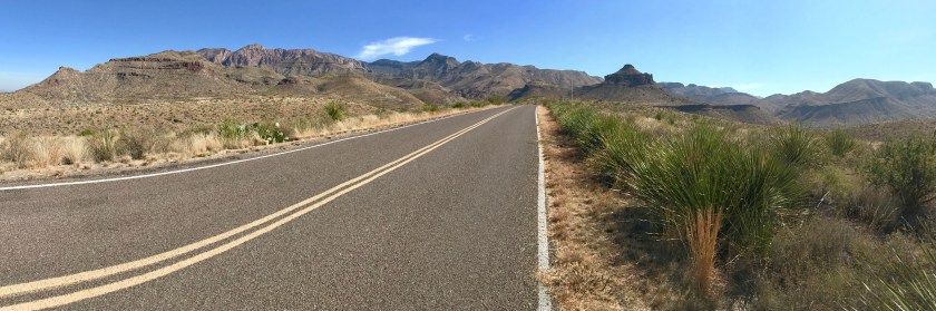
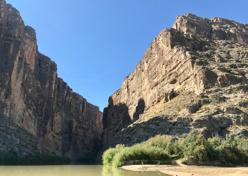
The road into the park winds along the Rio Grande river and it was just kind of shocking to me that this narrow ribbon of swift moving water was all that separated me from the country of Mexico.
A view of the Rio Grande River in Big Bend State Park. The state of Chihuahua, Mexico stands on the other side of the river.
The road along the river was a roller coaster ride, up and down and around curves, and my stomach was doing somersaults as I cautiously glanced away from the road to try to take in views now and again. I made it to the campground just as the sun was setting and chatted up my neighbors to find they were from Woodinville, WA. Small world! They were just lovely people. We swapped travel tales over cocktails and they pointed out constellations as the stars came out.
Sunday, November 12th, I was up early and watched the shades of pinks and purples work their magic over the surrounding landscape as the sun rose.
I pushed on from the state park heading for Big Bend National Park. I stopped along the drive so that Roo and I could dip our feet in the Rio Grande.
The Rio Grande.
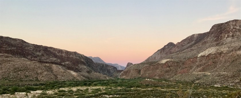
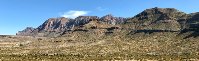
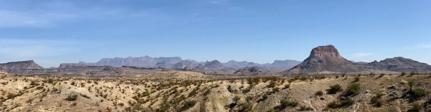
I hit the National Park entrance and decided to check out the 30 mile Ross Maxwell Scenic Drive before hunting up a campsite for the eve. WOW! WOW! WOW! The views were amazing.
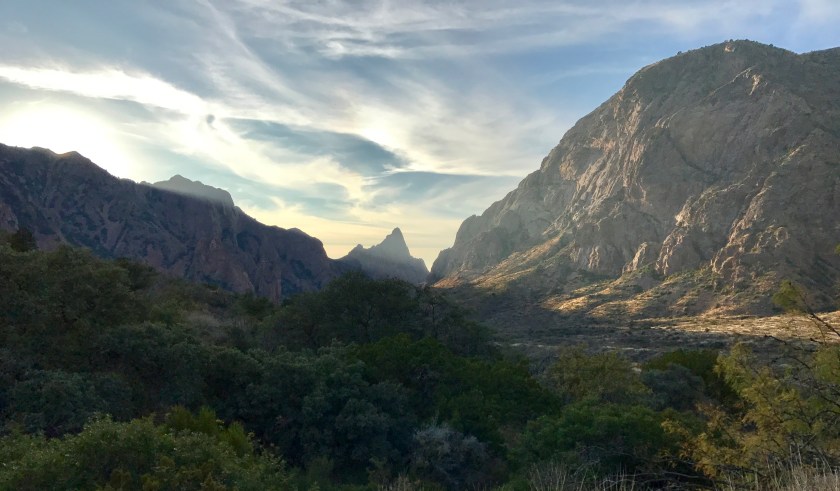
After the Ross Maxwell scenic drive I headed up another scenic drive into Chisos Basin, elevation 5400 feet, and secured a campsite.
Campsite #43 at Chisos Campground.
I spent the evening sipping cocktails while watching the light and shadows play over the surrounding hills. Best TV ever!
Monday, November 13th I was up and on the road early. There was hardly any traffic as I sped across the high desert, glancing off at the cloud shrouded mountains in the distance.
I SO wanted to divert to go see what goodies these distant mountains contained but Thanksgiving was approaching and South Carolina was still quite far away. I had to get serious about covering distance and I left the side roads and hit the Texas interstate.
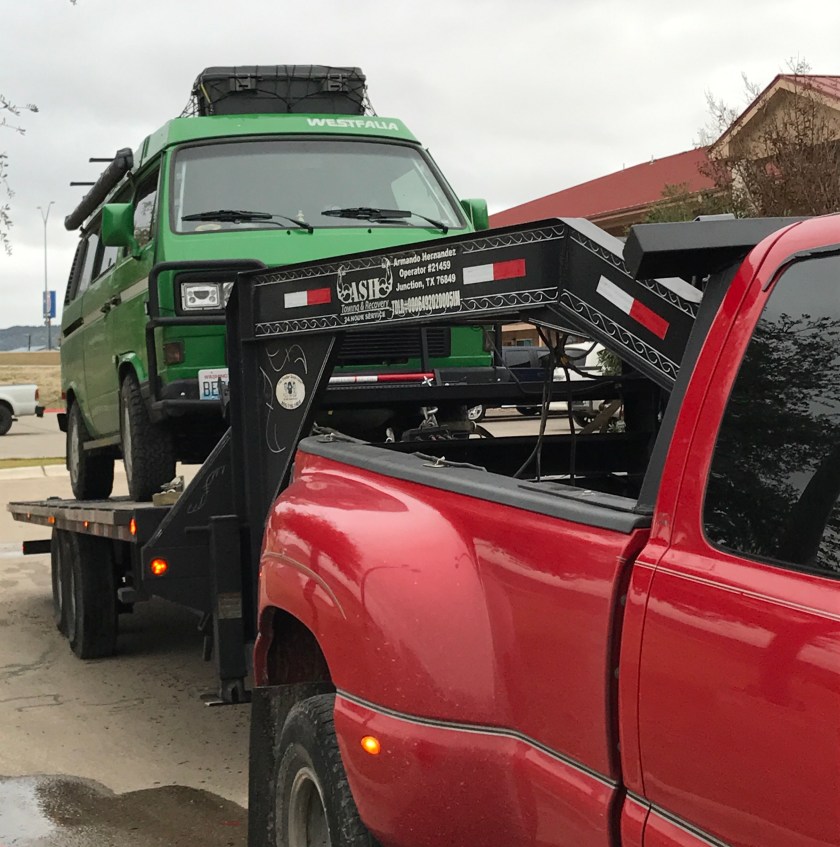
The interstate was not fun. I figured I’d be traveling long flat stretches of road but instead encountered rolling hills. It was drizzling rain and windy. The speed limit was 80 mph and truck traffic on the two lane highway was heavy. I couldn’t maintain a consistent speed on the highway with the headwind and hills. Tractor trailers sped by me on the uphill stretches, practically blowing me off the road and temporarily blinding me with the water they kicked up off the road. I was STRESSED and wanted this stretch of driving to come to and end as quickly as possible. Unfortunately I pushed Greta too hard by trying to keep her at 80 mph while fighting the headwind and I caused a major mechanical failure. So dumb!
I found myself stranded in Junction, TX in the late afternoon, trying to figure out what the heck I was going to do. Things looked pretty bleak but the road trip gods were on my side and the right people at the right time materialized to help me through this rough patch. Customer service at AAA, a kind mechanic and tow truck operator helped me work through the best options and I landed on a plan to overnight it at the Best Western Hotel in Junction, TX and then tow Greta to a VW dealer in San Antonio the following day. SO glad I signed up for the AAA Premier RV membership before hitting the road! It was coming in handy.
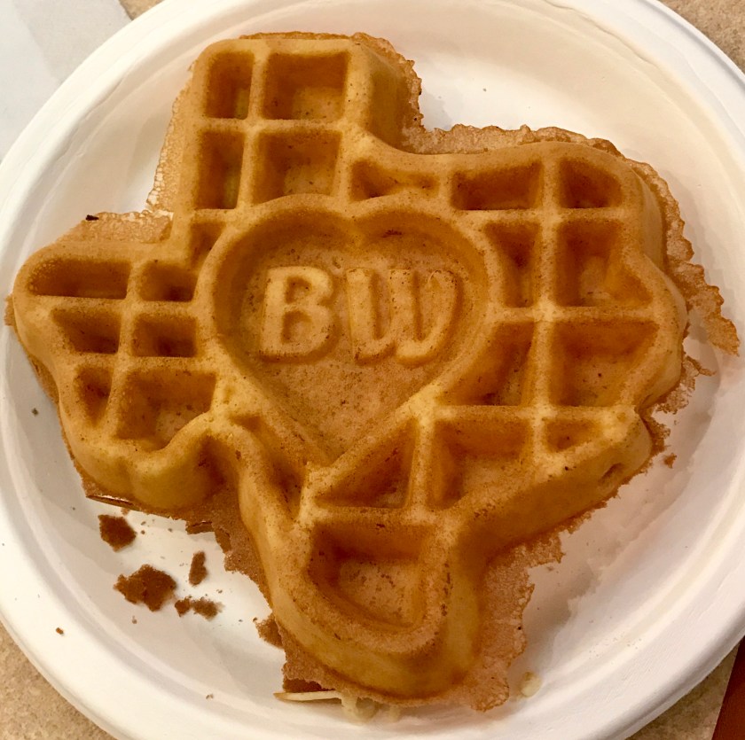
Tuesday, November 14th started off with breakfast at the hotel in Junction, TX with Texas shaped waffles. AWESOME!
Greta was towed 2.5 hours to San Antonio, TX for repairs. I chatted with the tow truck driver who had grown up in the Junction, TX area. His family had lived in the area for several generations and his grandfather had been a mohair goat rancher, an industry that had anchored the area at one time but died out suddenly. He had witnessed the slow decline of his home town. Drugs and poverty were now a big problem. On a positive note, the recent addition of a major truck stop hub just off the highway was providing a bit of a boost to the town and is probably why a Best Western hotel existed there at all.
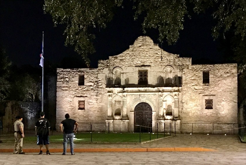
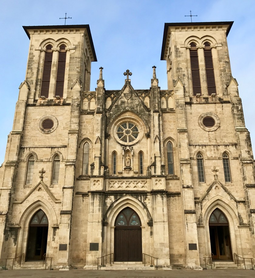
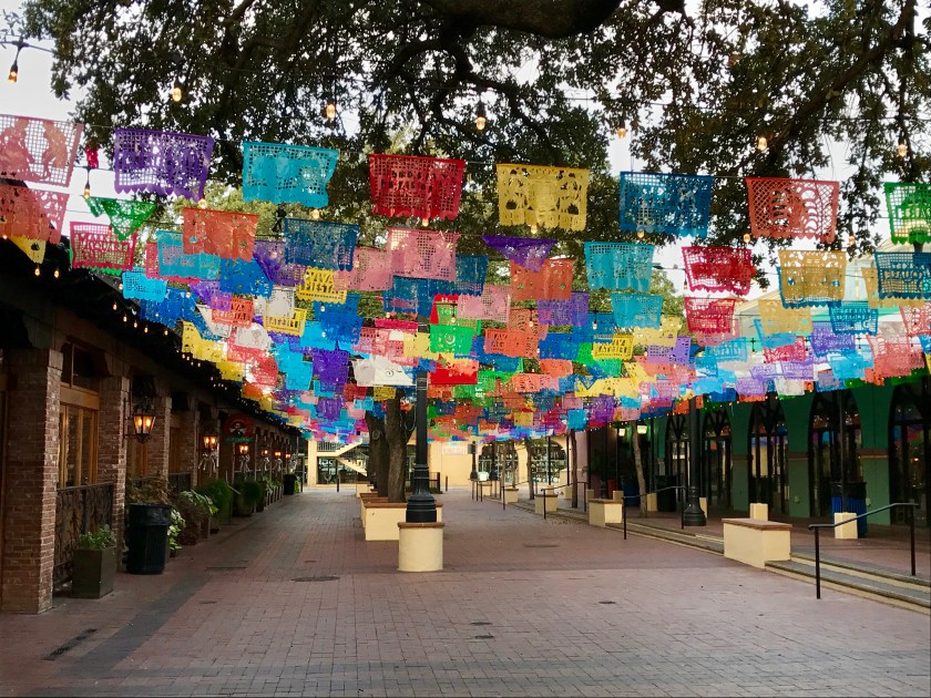
While Greta was in the shop, I spent 3 days exploring San Antonio. San Antonio had not been on my planned route but in terms of places to get stuck for a few days, San Antonio is a great place to be stranded. I walked all over town the historic part of downtown checking out the colorful Market Square, the historic architecture and reacquainting myself with the history of the Alamo.
Remember the Alamo!San Fernando CathedralMarket Square
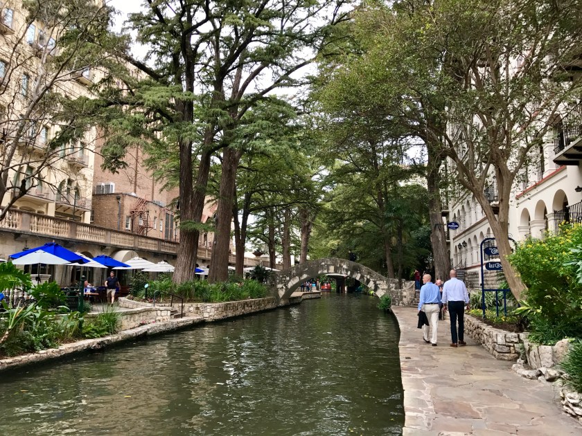
The historic riverwalk, a Texas version of Venice (sort of), in historic downtown San Antonio, was a pleasant surprise.
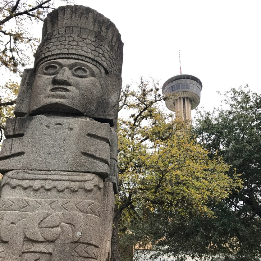
There was no shortage of public art to enjoy while wandering around downtown.
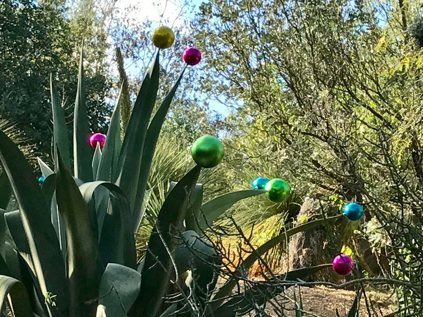
I geeked out on weird and wonderful plants at the San Antonio Botanical Garden and enjoyed seeing how they approach holiday decorations.
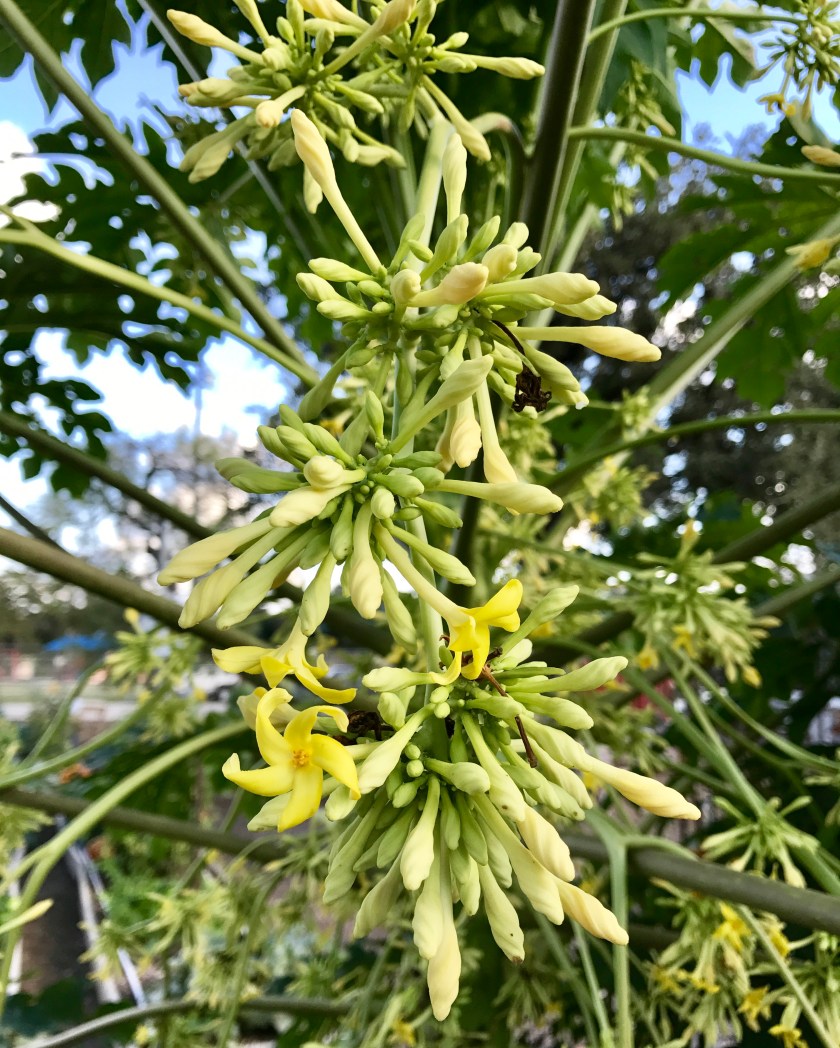
The flowers of a papaya plant.Don’t know what this is but I like it.Pond cypress.Holiday decorating, San Antonio style.
The number of butterflies in San Antonio was amazing. I’d never seen so many butterflies flitting around before and witnessed a feeding frenzy while touring the botanical garden.
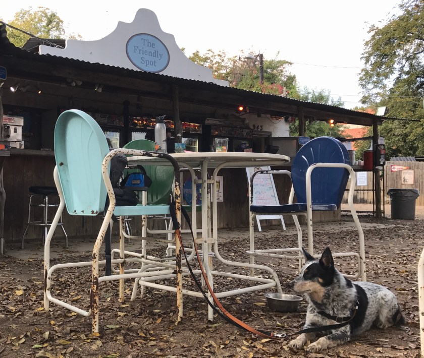
San Antonio boasts a high number of restaurants per capita and I ate very very well while poking around town. I drank pretty well, too. An evening sampling bourbon concoctions at The Esquire Tavern, the oldest bar on the riverwalk and home of the longest bar in Texas, was a treat. The Friendly Spot, boasting 70+ taps and a dog friendly outdoor setting, was another favorite.
The Friendly Spot
The best thing about San Antonio were the people. I found folks to be friendly, helpful and eager to strike up a conversation which I so appreciate as a solo traveler.
The only negative to San Antonio was mosquitoes. I had been relatively unbothered by bugs on the road trip so far but as I made my way farther east into Texas, the weather had become hotter and more humid. I learned the hard way that going outside without dousing yourself in bug spray first is a bad idea. By the time I was leaving town I was covered in mosquito bites, mostly on my ankles and feet. Torture!
Friday, November 17th, Greta was road ready once again and driving better than ever. The folks at North Park Volkswagen in San Antonio had been wonderful and their lead technician did a fantastic job repairing the van. I was so relieved and felt very fortunate to have connected with the right people at the right time once again and shouted thanks to the road trip gods as I drove out of town.
Because of the delay due to the breakdown I now had about 4 days to cover 1200 miles. Yikes! I tried to plot out the most direct route possible but a route that avoided major cities like Atlanta and New Orleans and that would be gentle on Greta.
I had hoped to spend Friday night on the Texas Gulf Coast at Sea Rim State Park but unfortunately I ran out of daylight and ended up spending the night in a smelly and dank hotel just off the highway in Winnie, TX. My ‘souvenir’ from Winnie was more mosquito bites.
Saturday, November 18th and I was on the road early. Buh bye, Winnie! I crossed into the state of Lousianna and popped into Lafayette, LA, which claimed to have the most restaurants per capita. (Hmmm…several cities along the way had made this claim.)
I found the cute, historic part of downtown and I enjoyed an AWESOME fried shrimp po’ boy at Pop’s, a damn good find! After lunch, I covered some ground on back roads, avoiding a nasty traffic backup on the highway around Baton Rouge, and I saw sugar cane fields for the first time on the trip.
Sugar cane fields.
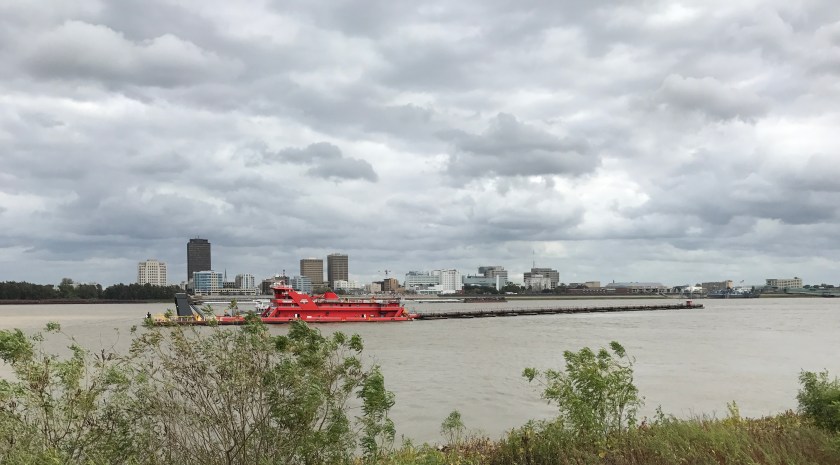
I made a brief stop near Baton Rouge to snap a picture of the Mississippi River. Its nickname, the Big Muddy, is well earned.
The Mississippi River and Baton Rouge.
From the Baton Route area, I skirted north of New Orleans along highway 10, crossed over the Louisiana/Mississippi state line and made my way to the Gulf Coast to overnight in Bay Saint Louis, MS.
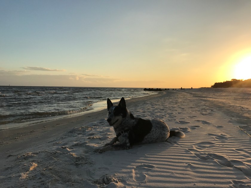
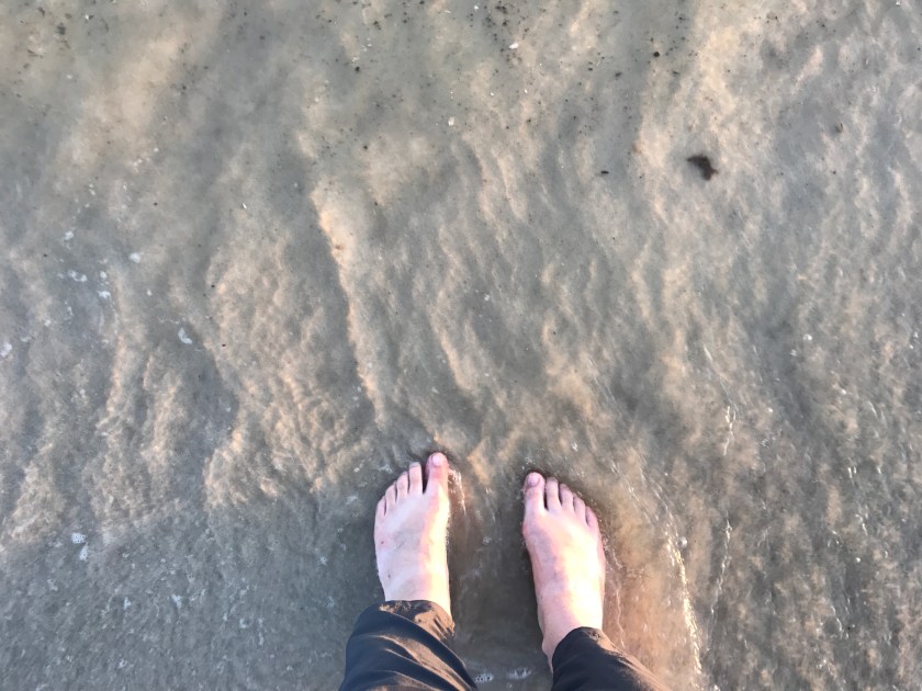
My airbnb was a dump but the location was great, just one block from a beautiful, clean white sand beach in a quiet neighborhood of seaside cottages and old estates. Roo and I caught the sunset and I dipped my feet in the Gulf of Mexico, a first for me, before I headed into the adorable seaside business district part of town and treated myself to a fancy, expensive dinner to make up for the dumpy airbnb rental.
Sunset at Bay Saint Louis, MS.The Gulf of Mexico.
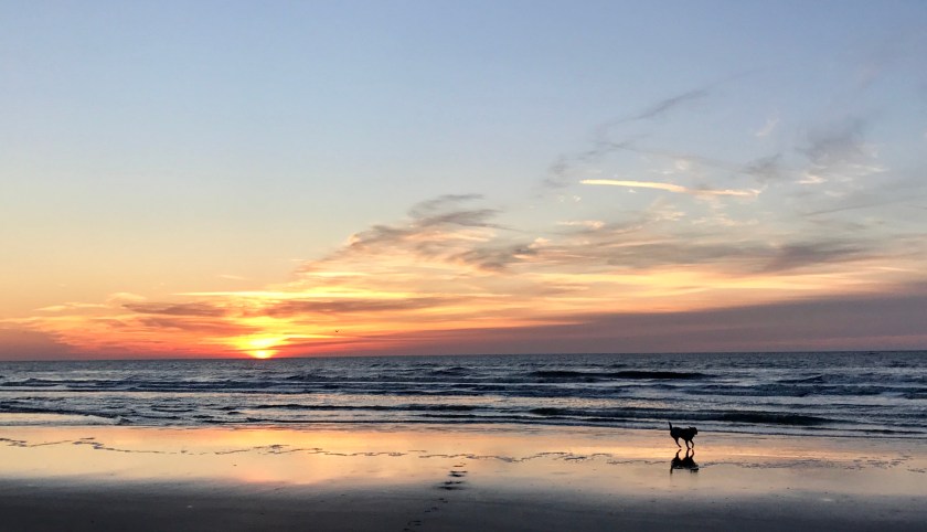
Sunday, November 19th, Roo and I were up early for a sunrise romp on the beach before hitting the road.
Sunrise run on the beach in Bay Saint Louis, MS.Roo catching her breath on the beach at Bay Saint Louis, MS.
From Bay Saint Louis, MS I made my way northeast and crossed over into Alabama. It was a boring day of highway driving and when I finally couldn’t take the monotony of the highway, I decided to take a chance trying minor side roads. It was a relief to leave the highway and I found the side roads to be well maintained yet practically deserted with speed limits of 60. I could move out AND the scenery vastly improved as I drove rolling hills through small towns and past farms and fields.
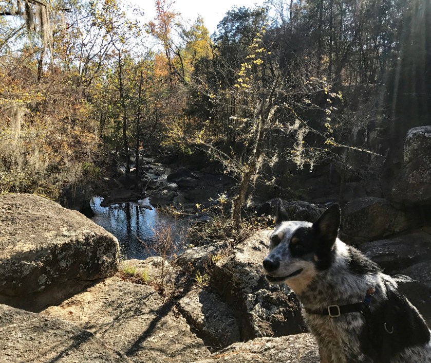
Roo and I stopped at Chewacla State Park, not too far outside Auburn, AL and enjoyed a nice long hike.
Hiking at Chewacla State Park
I had hoped to camp at the park for the night but the campground didn’t look all that appealing and I was worried about mosquitoes. I decided to push on and crossed over into Georgia towards the end of the day and stopped in Columbus, GA for the evening. I was pleasantly surprised to find a cute little historic downtown area with good dining options and Too and I wandered around and I enjoyed a couple of beers before finding a hotel for the evening.
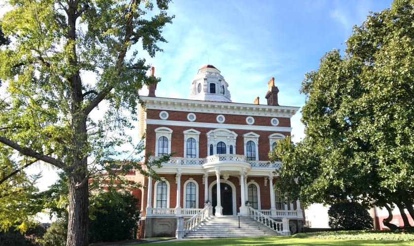
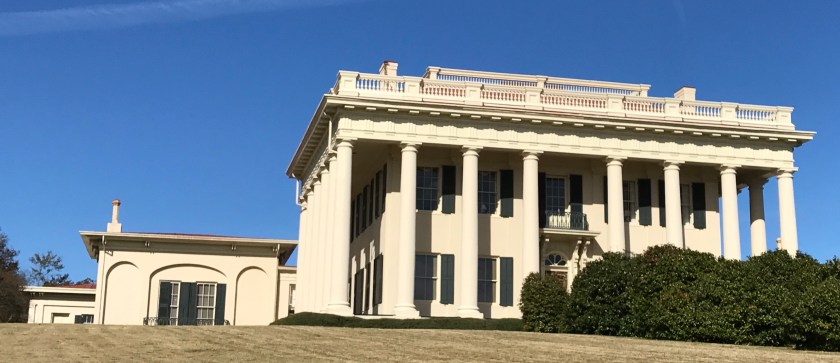
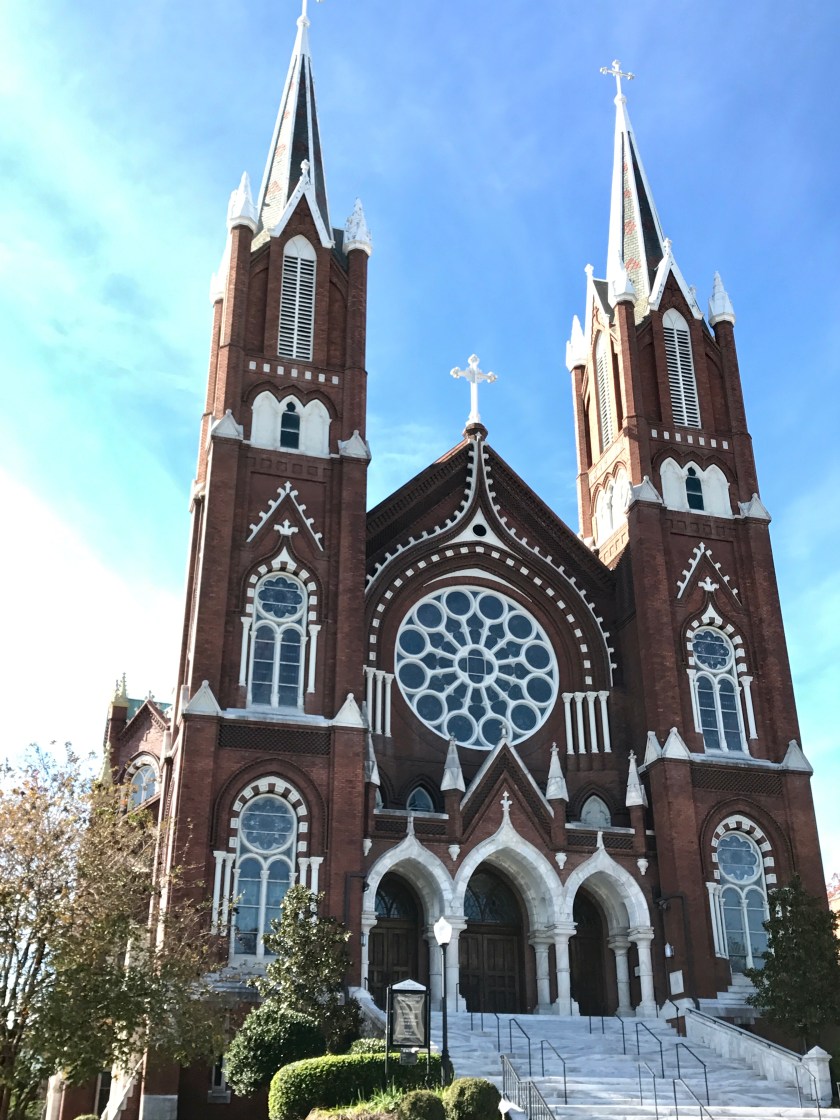
Monday, November 20th, I pushed off early for my last day of driving. Woo hoo! I stopped in Macon, GA for what I thought would just be a quick little stop. But I found the history and architecture of the town so intriguing and it was such a pleasant fall day that Roo and I ended up poking around town for close to two hours.
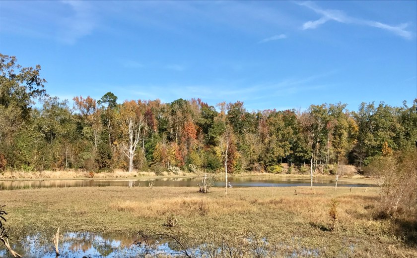
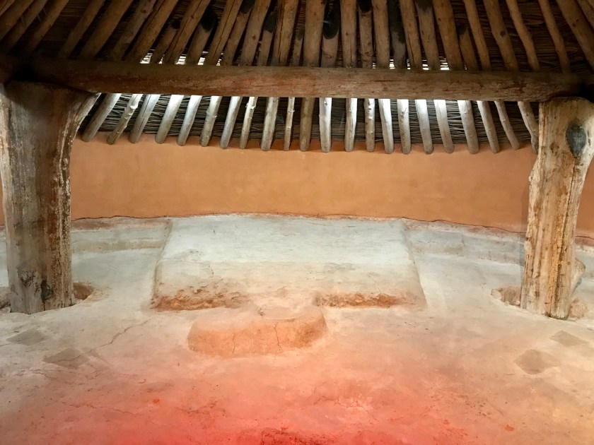
As I was driving out of Macon a sign for the Ocmulgee National Monument caught my eye and I went to check it out. It’s a park dedicated to the preservation of a prehistoric Indian site. They estimate people inhabited this site 17,000 years ago! It was a gorgeous fall day and Roo and I enjoyed walking the trails while checking out restored earth mounds, dating back 1,000 years.
Hiking the trails around Ocmulgee National MonumentReconstructed Earth Lodge at Ocmulgee National MonumentEarth Lodge floor dates back 1000 years.
From Ocmulgee National Monument I headed towards Aiken, SC, taking backroads. It was beautiful, easy driving and I passed cotton fields and, to my surprise, fields and fields full of solar panels. I did not expect to find solar farms in Georgia.
I arrived at my parents house in Aiken, SC that afternoon and felt a huge sense of relief and accomplishment. The first major leg of the road trip was complete and Roo and Greta and I had arrived in one piece without any major mishaps.
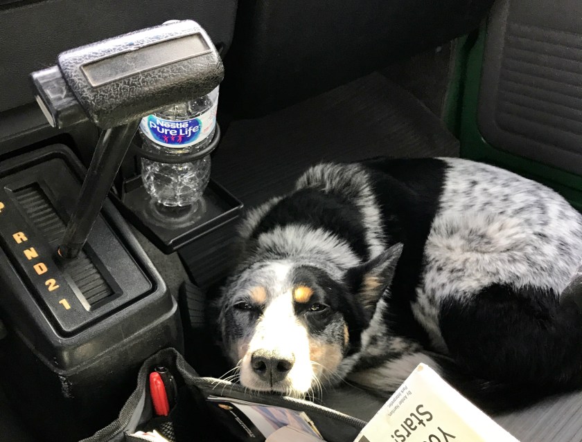
I looked forward to a break from the road as did Roo. Poor Roo… she still doesn’t like driving in the van although she’s ready for adventure as soon as we come to a stop. I was glad to know I wasn’t going to have to look at the sorry site of Roo looking up at me with her sad face from the passenger side floor, at least for a several weeks.
I intended to spend the holidays with my folks in South Carolina, plotting out a plan for 2018. Roo and Greta and I will hit the road again January 1st, 2018, weather permitting. Stay tuned!
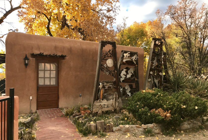
Thursday, November 2nd, Roo and I took one last stroll around Santa Fe, NM, checking out Canyon Road in further detail. Dang it! Why hadn’t I spent more time perusing the galleries on Canyon Road?? The galleries looked really interesting but it was early morning and nothing was open so Roo and I just had to peak in windows and over walls to see what we were missing.
Canyon Road, Santa Fe
From Santa Fe, I headed northwest to Abiquiu where I had booked a tour of Georgia O’Keefe’s home and studio. What a fantastic experience! The house is still decorated as it was when she passed away in 1986. The simple austerity of her home was beautiful. There is little clutter and what is out on display are generally things found in nature. Apparently if coming to Ms. O’Keefe’s for a dinner party your best best was to bring an antler or bone or rock as a hostess gift rather than a bottle of wine.
The doorway that so intrigued Ms. O’Keefe when she first saw the property and compelled her to buy it.
Simple, natural, beautiful
The view from Georgia O’Keefe’s studio.
After the O’Keefe tour, I went to check out the Plaza Blanca, the White Place, a unique geological formation that became a subject of Ms. O’Keefe’s paintings. Scenes in the Star War movies were also supposedly shot here. Other worldly!
Plaza Blanca from afar.
Hiking into Plaza Blanca.
I returned to the Ojo Caliente Hot Springs Resort to spend the night, one of the few repeat visits so far on the trip and well worth it. I enjoyed another night of floating on my back in the pool, stargazing, and another wonderful meal at the restaurant. I started off the camping night with the furnace nicely humming and keeping the van warm.
Friday, November 3rd, I awoke to a chilly van and the furnace flashing a fault warning again. DAMN IT! Looked like I was in for chilly camping for awhile.
Roo and I packed up and headed from Ojo Caliente to Taos. We hit Taos, drove through town and found some excellent coffee and grub at The Coffee Apothecary. I swung back and headed back into Taos to park and poke around.
I visited the Taos Art Museum at Fechin House. I wasn’t there to see the art really… that was a bonus. I was there to see the house that had been bought and remodeled, blending Russian design motifs with the traditional adobe structure, by the artist Nicolai Fechin in the 1920’s and 1930’s. Fechin carved much of the exposed wood surfaces and furniture himself.
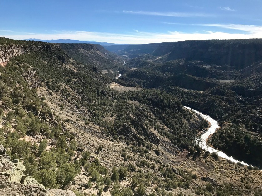
After checking out the museum, I started meandering north to check out some of the smaller towns around Taos. I sign for the Rio Grande del Norte National Monument caught my eye and I drove over to check it out. Whoa! Incredible views of where the Red River and Rio Grande River meet. Unfortunately this is one of many national monuments under threat of losing national monument status under the current administration. Disheartening for sure.
The Rio Grande at the Rio Grande del Norte National Monument.
I drove around to the various viewpoints in the park, walked Roo around a bit and then we started making our way back to Taos to find our airbnb for the evening. It was a nice little casita tucked down a side street, with a fenced in backyard where Roo could sniff around. It was a very quiet and chill spot, the only disruption coming from the magpies flying through at sunset. What a ruckus!
Saturday, November 4th, I headed out early and found great coffee and breakfast at The Coffee Spot. Then I headed to the Taos Pueblo, an ancient Taos Indian pueblo that has been inhabited for over a 1000 years and designated as a UNESCO World Heritage Site. Currently about 150 people live there today in similar conditions as their ancestors. Access into the pueblo is restricted. You can’t just go walk around where ever the hell you feel like. This is where people live. It was really cool seeing the architecture and historic buildings and imaging life in a village like that but I didn’t linger long. I felt sort of like an intruder.
From the Pueblo I headed back into Taos to walk Roo while poking around the downtown plaza area. I found super cute winding, narrow alleys with cobble stone streets with art and crafts everywhere.
This statue/sculpture in Taos freaked me out the longer I looked at it.
From Taos I started making my way back south via scenic backroads to Santa Fe to catch the full exhibit at the Georgia O’Keefe Museum. I stopped again in Chimayo but this time for lunch at the Rancho De Chimayo Restaurant. It’s in a historic building and they serve up some excellent food. SO GOOD! Very much worth a stop.
Late afternoon I arrived in Santa Fe and went straight to the Georgia O’Keefe museum. It was SO worth it to have hung around northern New Mexico for a few extra days so that I could catch the full exhibit before moving on.
After the museum, I spent a quiet evening at a sweet little casita north of Santa Fe, out in the farm land on the edge of town.
My airbnb casita on the edge of Santa Fe.
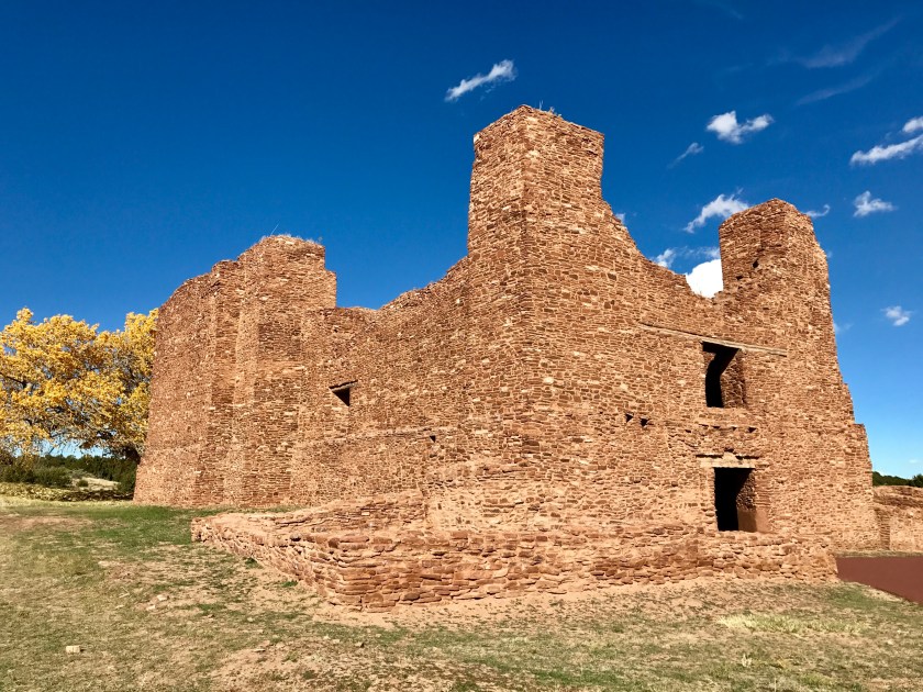
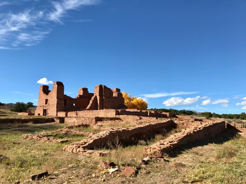
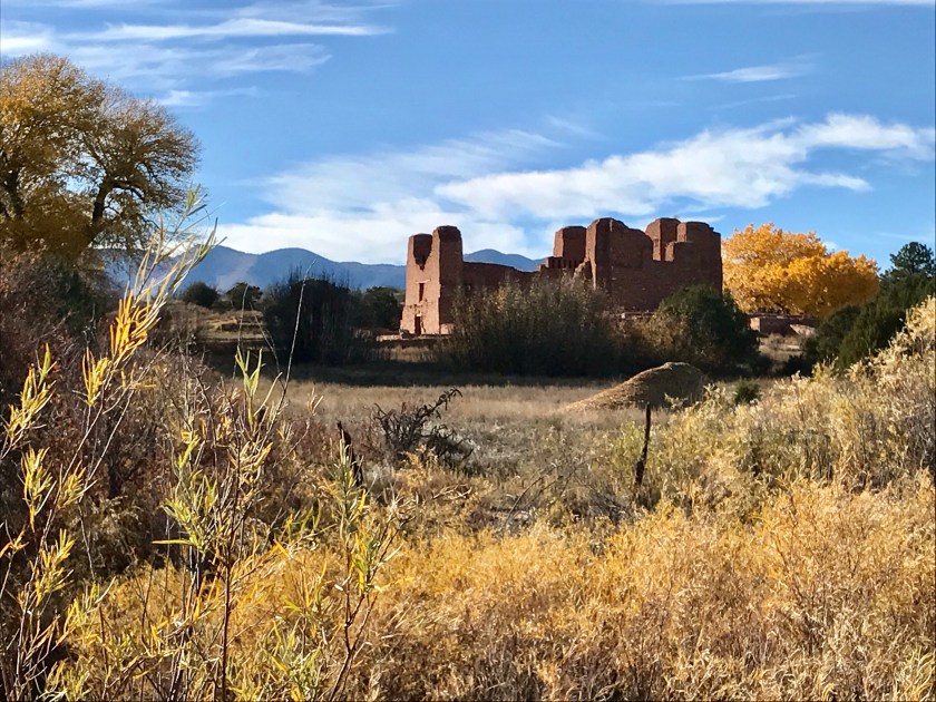
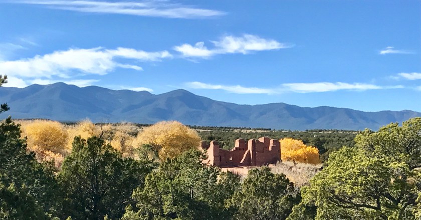
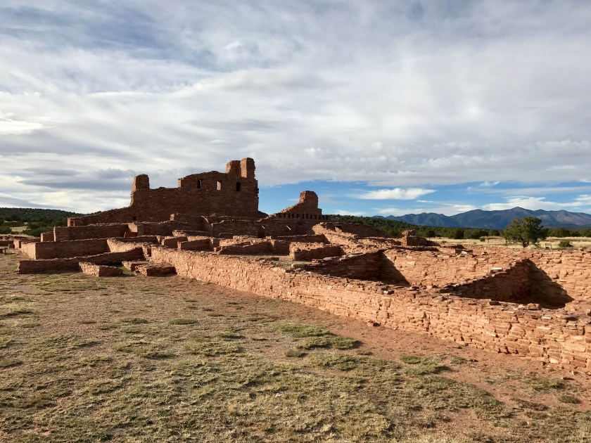
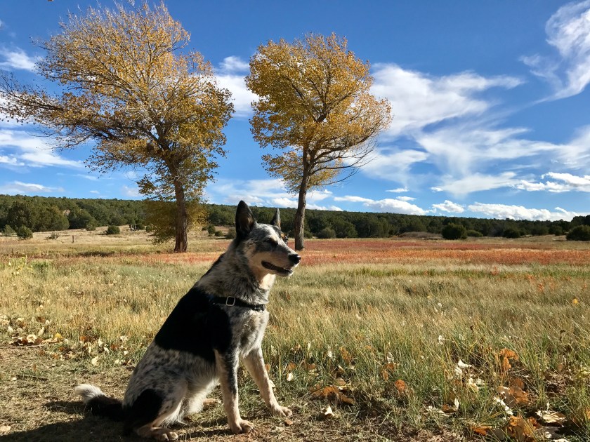
Sunday, November 5th, I started heading south out of Santa Fe, choosing a scenic route along route 14. We drove through the adorably cute and artsy town of Madrid… must return to check that out further on the return trip. I stopped for a quick hike with Roo in the Cibola National Forest near Sandia Park, NM. And then back on the road and I took another quick diversion to check out Manzano State Park. The park was a waste of time and I didn’t linger but the drive was quite scenic.
Roo and I hiked all around the ruins at both locations, enjoying the gorgeous fall day.
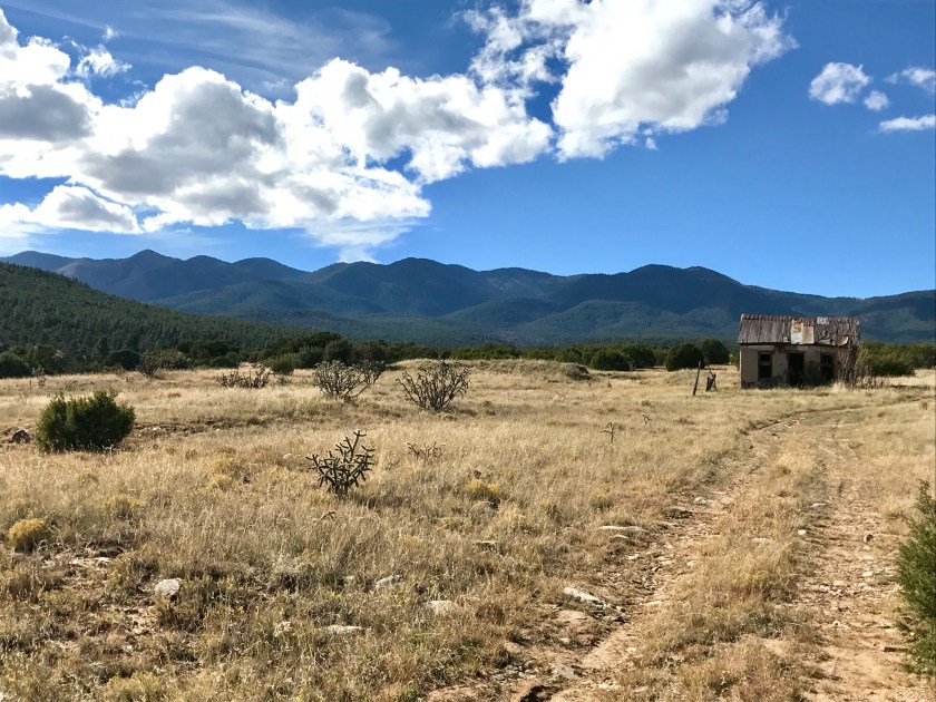
I had kind of dilly dallied a bit at the ruins and the sun was starting to get low as I headed towards San Antonio, NM, my intended overnight stop.
I ended up rolling into San Antonio, NM after the sun had gone down for the day, hunting for our airbnb. We found the funky little trailer rental and settled in for the evening.
Monday, November 6th, I was up at the crack of dawn, awoken by a honking that seemed to be getting slowly closer and closer to the trailer. It turned out to be a peacock making it’s way down the street towards the trailer that was disrupting the morning peace.
Our funky airbnb in San Antonio, NM.
I got the van packed up and headed out to check out the Bosque Del Apache Wildlife Refuge. First, I geeked out over plants in the Desert Arboretum near the visitor center.
Then I headed over to the wildlife viewing area and I saw migrating snow geese and sandhill cranes (amongst other birds). Seeing the snow geese on their southern migration was a special treat as I had seen snow geese earlier in the year in the Skagit Farmland in northwest Washington as they migrated north.
The sandhill cranes were surprisingly large and made quite a racket with their chatter but they were shy and hard to get close enough to to get decent photos but the below video at least gives you a taste of the sound they make.
After bird watching, Roo and I did a great loop trail hike up through a slot canyon and to a ridge with a 360 degree of the refuge and surrounding mountains and plains.
Bosque del Apache Wildlife Refuge ended up being a great stop. I didn’t realize that a wildlife refuge might actually incorporate in agriculture activities in an attempt to provide habitat and food and it was a fascinating blend of farmland and wilderness.
From the Bosque Del Apache Wildlife Refuge I continued making my south, headed for the town of Truth and Consequence, NM to grab a late lunch. The town has hot springs and on a whim I decided to see if I could get in a soak. I secured a private hot spring pool at Riverbend Hot Springs and it was pretty dang sweet! Well worth the stop.
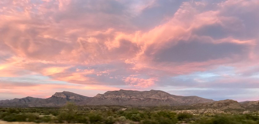
From Truth or Consequences, NM I continued my drive down the highway as the sun was setting. I tried not to drive off the highway as I watched the sky and mountains turns shades of pinks and purples.
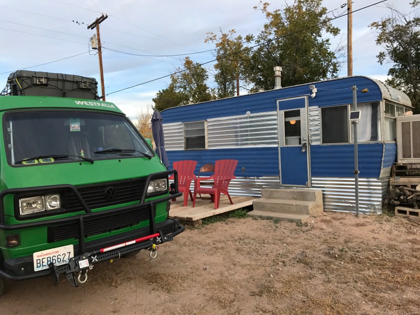
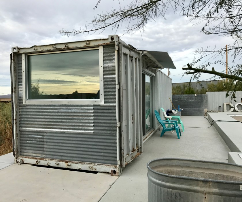
I rolled into Las Cruces, NM in the dark where I had secured an airbnb rental for two days. Time to get a load of laundry down and take a breather. The airbnb was awesome. It was a converted shipping container, something I had been wanting to see up close.
Tuesday, November 7th, I awoke to a lovely view of the sunrise over the distant mountains.
The airbnb rental was out on the edge of town and I could do morning hikes with Roo out into the desert straight from the rental. It was awesome! We poked around that day, I caught up on chores and did my best to stay in one place as much as possible.
Hiking out in the desert from our airbnb in Las Cruces, NM.
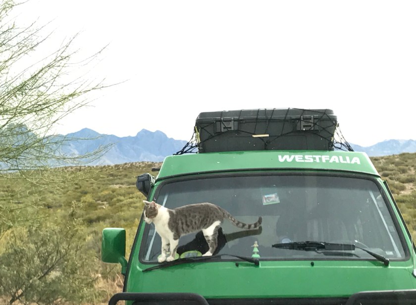
Tuesday, November 7th, we started off the day with a visit from a cute little kitty checking out Greta. Turns out the damn cat actually broke that windshield wiper, which I wouldn’t realize until I hit rain a few days later. Doh!
I headed to Dripping Springs Natural Area just outside of Las Cruces for a hike, based on recommendations from the airbnb hosts and I was completely caught off by guard by the amazing scenery. Roo and I hiked up to check out the waterfall which was just a trickle at this time of year.
Wednesday, November 8th, we woke to find it rainy. What?! I hadn’t seen rain in days. It was kinda of neat to experience the desert after a rain. It’s so fragrant with the scent of juniper and sage.
I enjoyed a last hike in the desert, packed up the van and started to head south. I crossed over the New Mexico/Texas border and a roadside sign read “Thank you visiting New Mexico – the land of enchantment.” I hadn’t known that was the state motto but it was fitting. I had indeed found New Mexico enchanting and I’ll definitely be coming back for further exploration of New Mexico in 2018.
I left SE Oregon on Friday 10/6. It was time to do laundry and get a real shower so I needed to find a town with some services where I could take care of business. I had done a little research online and thought Winnemucca, NV looked like a town worthy of exploring. Well, Winnemucca should be called Winne-YUCK-a. I couldn’t get out of there fast enough. If you like casinos, you might like it but that’s not my scene.
On Saturday, 10/7, I said good-bye and good riddance to Winne-SUCK-a and headed southeast towards Austin, NV via route 305. It was pretty but barren country, nothing but wide open sage brush pasture land, hedged in on each side by barren looking mountains. Other cars and trucks on the road were few and far between.
As I approached Austin, NV to connect with Highway 50, I started to climb in elevation and trees started appearing back in the landscape. The smell of juniper and pine and sage filled the van.
Austin, NV sits at 6600 ft. I found a well preserved town with some cool old prospector style buildings. Better yet I found a place that served a decent burger.
After Austin, NV the road continued to climb up to Austin Pass at about 7500 ft. Views were spectacular but I felt very exposed. This section of Highway 50 is winding at times with no shoulder and no guard rail in places.
About 30 minutes outside of Austin, NV, I diverted off Highway 50 to find Spencer Hot Springs. It’s a well known and a well used hot spring. Camping is dispersed through the sage brush hills so it’s possible to find privacy despite the popularity of the hot springs. When I arrived I wasn’t initially clear where the hot springs were located exactly so I parked and jumped out and started walking around. I saw what appeared to be somebody’s campsite and didn’t want to encroach but it also felt like the way to the hot springs. Well, it WAS the hot springs and these jackasses had actually set up their campsite, car and tent and fire pit and all their stuff RIGHT NEXT TO THE HOTSPRING. Lame! Lame! Lame!
Spencer Hot Springs and an example of how NOT to set up camp at a hot spring site.
It turns out there are actually several hot spring pools at Spencer Hot Springs and I found a nice camping spot about a 100 yards away from another hot spring area where fellow campers were better versed in proper hot spring camping ettiquette.
I set up camp and enjoyed a couple of cocktails and watched the sun set over the plains and mountains. A group of wild burros picked their way down out of the hills to hang out with the campers and I could hear them braying, as well as coyotes yipping, as the evening light faded and the stars came out. Views went on for miles and I could see campfires flickering up and down the valley. The hotspring area cleared out relatively early and I enjoyed a nice quiet night.
The next morning, Roo and I had a nice walk around the sage brush hills as the sun was rising over the hills. Jack rabbits were all of the place and Roo gave chase. I know I should have tried to interrupt the hunt but I was mesmerized. It was just pure power and speed and animal instinct and it was marvelous to watch her tear after that hare through the sage brush. She came back, wild eyed and panting, looking like she had just had the time of her life. (No worries, no hares were harmed.)
Spencer Hot Springs area
On Sunday, 10/8, I packed up and took off from Spencer Hot Springs, continuing east along route 50. I stopped in Eureka, NV, for breakfast. The town had some very well preserved historic buildings, including an old opera house. Unfortunately about half were standing vacant and many were marked for sale. This must have been quite the town back in it’s heyday.
Eureka, NV
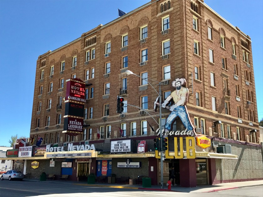
I kept driving east along route 50, stopping in Ely, NV to fuel up and to snap a picture of the Hotel Nevada and its fabulous signage.
Hotel Nevada in Ely, NV
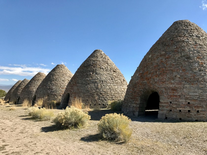
Just outside Ely, NV a sign for Ward Charcoal Ovens State Historic Park caught my eye and Roo and I made a quick diversion to check it out and get a quick hike in. The charcoal ovens, which are 27 feet in diameter and 30 feet tall, were built in the 1870’s and were used to produce charcoal to fuel the smelters in the area that were producing ore in support of the railroad and silver mining businesses. Filling each one of these ovens required 6 acres worth of trees. The ovens were run for 12 hours and resulted in about 50 bushels of charcoal. As the railroads completed their expansion west and the silver boom waned, the ovens fell out of use after only 3 years. In that short period of time the surrounding hills were stripped of all juniper and pinion pines for a radius of 35 miles. After the ovens fell out of use, they were used by stockmen and prospectors as shelters during harsh weather and legend has it they were used by stagecoach bandits as hideouts.
Charcoal Ovens built in the 1870’sView of the Charcoal Ovens from above.View from hike
I pushed on and made it to Great Basin National Park as the sun was going down and grabbed a campsite in the park. The ranger at the Visitor Center warned me that it was supposed to get cold that evening, in the teens. Roo and I settled in for the evening and the furnace was cranking, keeping us toasty. I work up at 4am and thought, dang it’s cold. Then I glanced at the furnace control and saw that it was blinking indicating the system had faulted. Damn! The furnace was out! The blinking pattern indicated the issue had something to do with the fuel supply lines, something I was not prepared to repair on the road. With temperatures dipping down into the 20’s and below in the evening, that meant camping was out until that was fixed. I just didn’t have the proper bedding for those temperatures.
In the early morning chill, after rallying to make coffee and pack up camp, Roo and I drove up to the Wheeler Mountain Campground at 10,000 feet and walked around. The campground was closed for the season and deserted so it was the perfect place for a walk with Roo. A creek bubbled it’s way through the campground and we checked out the crazy ice formations that had formed over night.
Great Basin National Park and Wheeler Peak
After the romp with Roo around the campground area, I went to do a tour of Lehman Cave. Wow! The cave system and formations are millions of years old and largely unchanged. The cave was discovered in the late 1800’s and turned into a tourist attraction. Early visitors were allowed to break off pieces of stalactites and stalagmites and carve their initials or names into the ceiling/walls. This is sad but also kind of fascinating. We could see inscriptions dated in the late 1800’s and early 1900’s. The cave was used as a speakeasy at one point and dances were held in one of the larger rooms. Now it’s a federal offense to even touch anything. I had to keep my hands in my pockets. I kept wanting to reach out and touch the walls. The lint and dust that comes in on visitors during the cave tours does harm to the caves. Periodically they shut down sections and volunteers dust the formations.
After the cave tour, I pushed off from Great Basin National Park, and continued heading southeast along the Ely Highway. The drive was pretty but this is, so far, one of the most barren and quietest stretches of road that I’ve driven to date.
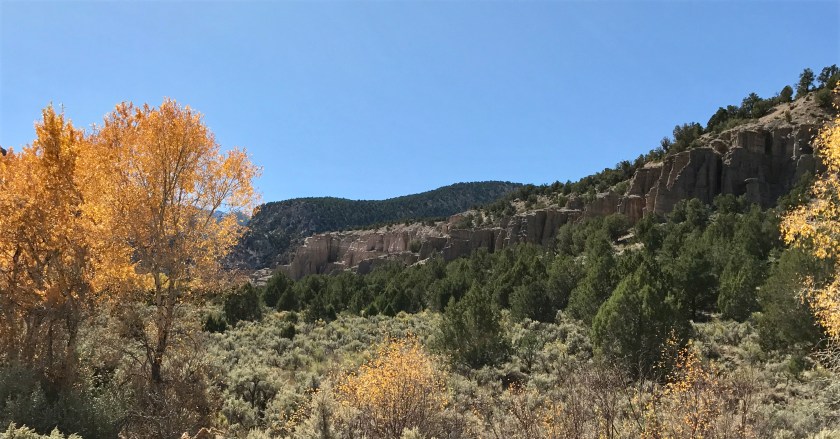
I stopped in Beaver, UT to overnight at a motel and then left Beaver on 10/10, intending to reach Capital Reef National Park that day. It was a pretty drive with lots to do along the way. First stop was at the Fremont Indian State Park off Highway 70 to do some hiking with Roo. I was pleasantly surprised to find petroglyphs.
Petroglyphs at Hundred Hands Cave
Mud Swallow’s nestsAutumn Color at Fremont Indian State ParkView from hike
From Fremont Indian State Park, I pushed on and the drive just kept getting prettier and prettier the closer we got to Capital Reef National Park.
A lake along the drive between Fremont State Park and Capital Reef National Park. Utah is so stinking pretty!
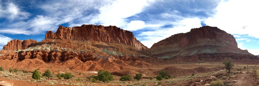
I arrived at Capital Reef National Park mid afternoon on Tuesday, October 10th and I spent that afternoon driving around the park. Holy cow! My pictures do not do this place justice!
The park contains the historic settlement of Fruita, Utah. Originally settled by a group of Mormons in the 1880’s, a few well preserved historic buildings still remain as well as the orchards that the town was named for. Visitors are allowed to pick fruit from the trees if they’d like.
Capital Reef National Park. Historic barn in Fruita, Utah.
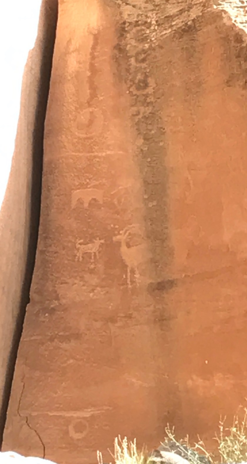
Petroglyphs attributed to the Fremont Indian culture, thought to be active in the area between 600-1300 AD, are visible not far from the visitor center.
Petroglyphs at Capital Reef National Park.
On Wednesday, 10/13, I left Capital Reef National Park to continue making my way towards Denver. My intended overnight spot was Fruita, CO. I had no idea what the drive would be like. Wow. Wow! WOW! The landscape was otherworldly. I couldn’t help wonder what early explorers and pioneers must have made of this landscape. It’s beautiful but it seems so inhospitable and unsuitable for humans.
View from Route 24, Utah.
On the drive, a sign for ‘Valley of the Goblins State Park’ piqued my interest and I decided to go check it out. Whoa… this place is on my list of places to return to someday. Roo and I had limited time to poke around and we did a quick hike but I think we barely scratched the surface of the geological wonders of this area.
Roo with ‘goblins’
After poking around Valley of the Goblins State Park, we drove on and made it to Fruita, CO late afternoon and I grabbed a cheap motel room for the night. Fruita, CO is one of the few places on this road trip that’s a repeat visit. I’d been here several years ago on a previous road trip. This is a great small town, known for the mountain biking in the area. Good food, good beer, good coffee and outdoor fun is easy to find. If you ever get to Fruita, CO, make sure to stop at the The Hot Tomato for pizza and beer. They make a mean pizza and it’s a fun and friendly place.
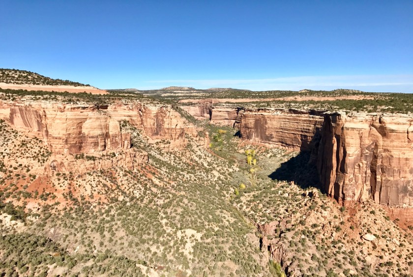
Just outside of Fruita, CO is the Colorado National Monument. I hadn’t had a chance to check this out on my previous visit so I decided to drive the historic 23 mile long Rim Rock Drive on my way out of town on Thursday, 10/12. A must do for anyone that visits that area!
View from Rim Rock Drive in the Colorado National Monument. The town of Fruita, CO is in the valley in the background.Big Horn Sheep along Rim Rock Drive.
From Fruita, CO I drove along I-70 towards Denver. The scenery was good from the highway but I can’t say it was a pleasant drive. People drive like freaking maniacs along I-70 and the winds can be strong and gusty causing the tractor trailers to occasionally jump their lanes. I was stressed out because Greta was having trouble with the Colorado mountain passes. I was ending up in the right hand lane doing 30 mph with the gas pedal to the floor, hazards on, hoping no one was going to read end me, a white knuckle grip on the wheel.
I was so relieved when I pulled of I-70 for the day, stopping first in Frisco, CO to down some german beer and sausages to calm my nerves before driving a few more miles on to Silverthorne, CO where I would spend a nice quiet evening at a friend’s mountain house.
I took off from Silverthorne, CO on Friday, 10/13. Denver was so close… just 70 miles away. I had a few more Colorado mountain passes to get over and I prayed to the road trip gods as I drove to please, please, please, just let me make it to Denver in one piece. Greta limped her way up and over each pass and finally we dropped down into Denver and arrived at my sister’s house. WHEW! I was so relieved and ecstatic to make it. Arriving in Denver was a major milestone and I was looking forward to taking a break from road life for a few days.
The next big road trip push starts Monday, 10/23, when my friend, Alyssa, arrives from Seattle to join me on the road from Denver to Santa Few, NM. In the meantime, I’m taking care of Greta issues and enjoying the Denver scene.
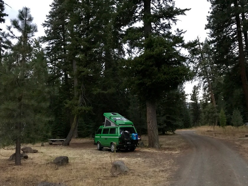
On 9/24, Roo and I pushed off from Joseph, OR. I decided to take the section of the Hells Canyon Scenic Byway that extends from Joseph to Halfway, OR, which follows Forest Road 39. The road is winding and steep and narrow at times. It cuts through the Wallowa-Whitman National Forest and provides access to some pretty wild and woolly country. I was hoping we’d find some quiet and secluded camping and I found just that at the Indian Crossing campground at the end of a forest service road along the Imnaha River.
Indian Crossing Campground.
We found a spot right along the river. I saw a handful of other campers and hikers. Most of the campers had horses at this campground and were using the campground as their launching off point for back country pack trips. It looked like a wonderful way to travel and experience the mountains. I was rather jealous.
We stayed at Indian Crossing campgrounds for two nights. Roo and I hiked up the Imnaha River the first afternoon after attempting to give a hand to a hunting party that was coming down out of the mountains after several days up at a hunting camp to find that both of their trucks would not start. They had packed in via horse 10 miles up in to the mountains and had seen wolf, coyote, bear and 4 herds of elk. News of wolves in an area always unnerves me. We were about 2 mins into our hike when I spotted something running around in the woods and I saw a pair of black canine ears poking out over the top of log. WOLF!!! I thought and I high tailed it down to the trail head and sat with Roo to see what materialized. Shortly a black border collie, followed by a brown border collie and then a couple of hikers and a cattle dog emerged. Ahhh… false alarm. So I took a deep breath and calmed down and again headed up the trail. Roo and I had a great afternoon hike and found some wonderful views of the river and surrounding mountains and Roo took a dip in the river.
Hiking along the Imnaha River.
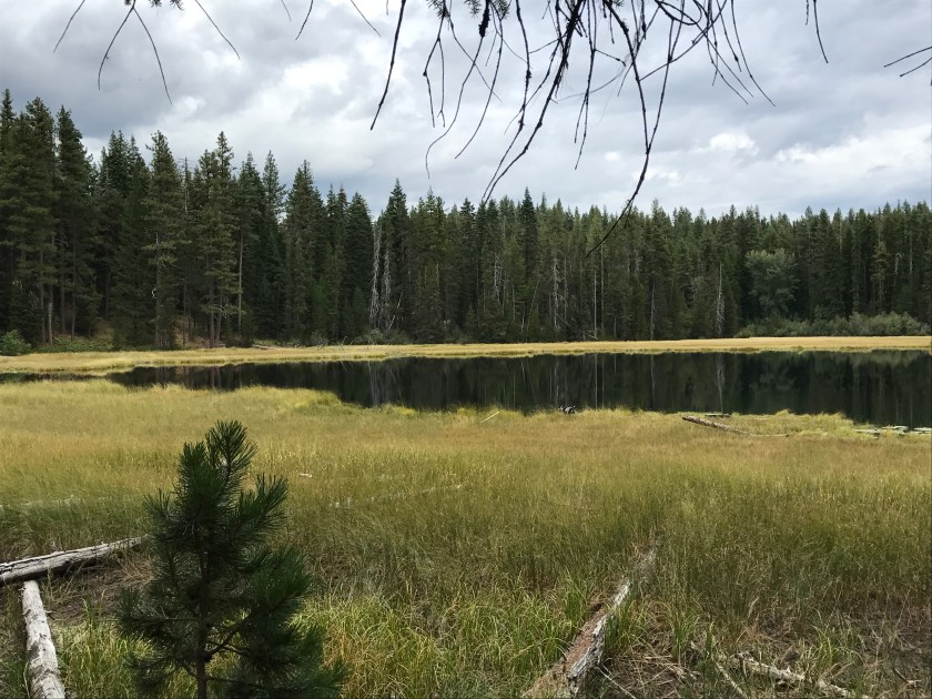
The second day, after lollygagging around the campground all morning, I hiked up to Duck Lake. Roo and I saw no-one on the trail. We startled one mule deer along the way but besides that, it was pure solitude. I enjoyed being serenaded by nothing other than the sound of the wind in the trees.
Roo roaming the shore of Duck Lake
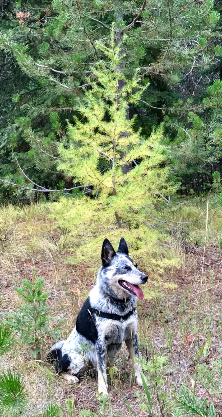
It being late September, autumn was starting to color the landscape and I was thrilled to find the larches turning their brilliant shade of yellow.
Roo and a baby larch.
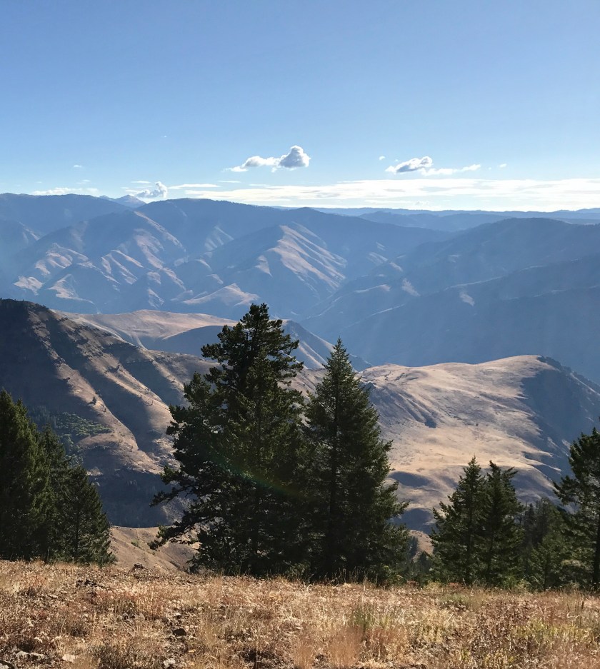
After 2 nights of camping, on 9/26, we pushed off to proceed along Forest Service Rd 39. We stopped to take in the view from the Hells Canyon Overlook. Whoa!
Hells Canyon Overlook along Rte 39.
As I wound down the steep and winding road, I came around a corner to see three cowboys and their horses on the side of the road, one guy with his thumb out appearing to be hitch hiking. I pulled over and he asked if I could give him a lift down to his truck. I was happy to oblige and he jumped in, chaps and spurs and hat and all, while I tried to make sure Roo didn’t try to take at a nip at him. I asked if they had been up camping but no, they were in the process of driving cattle down out of the hills to lower pastures for the winter. Ah ha… they were in the middle of their work day! The cows had gotten ahead of them and taken off down the road and he was hoping to get a ride to get ahead of the cows and cut them off before they got passed the point where their trucks and trailer were parked. So we took off down the road and shortly passed the cows trotting down the road. They gave us the hairy eyeball as we passed… I don’t think they knew what to make of Greta… and when we got to where the trucks and trailers were parked, he jumped out of the van with a ‘Thank you, maam.’ and tip of his hat.
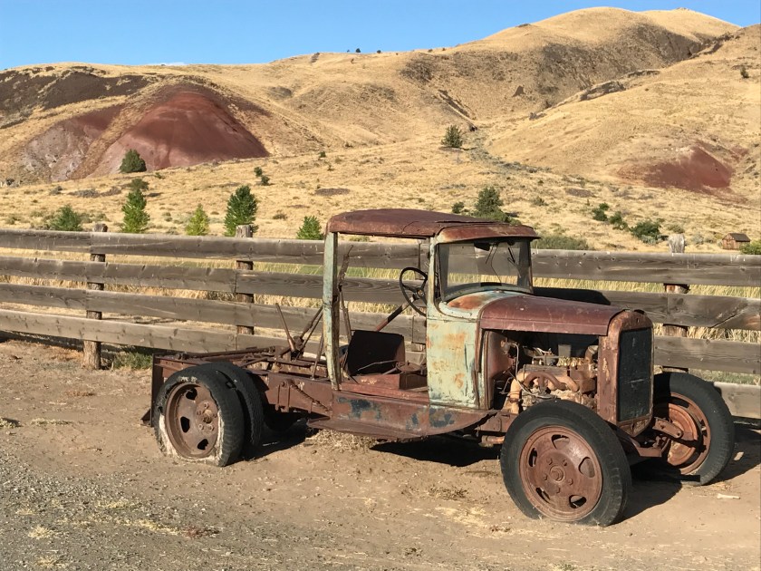
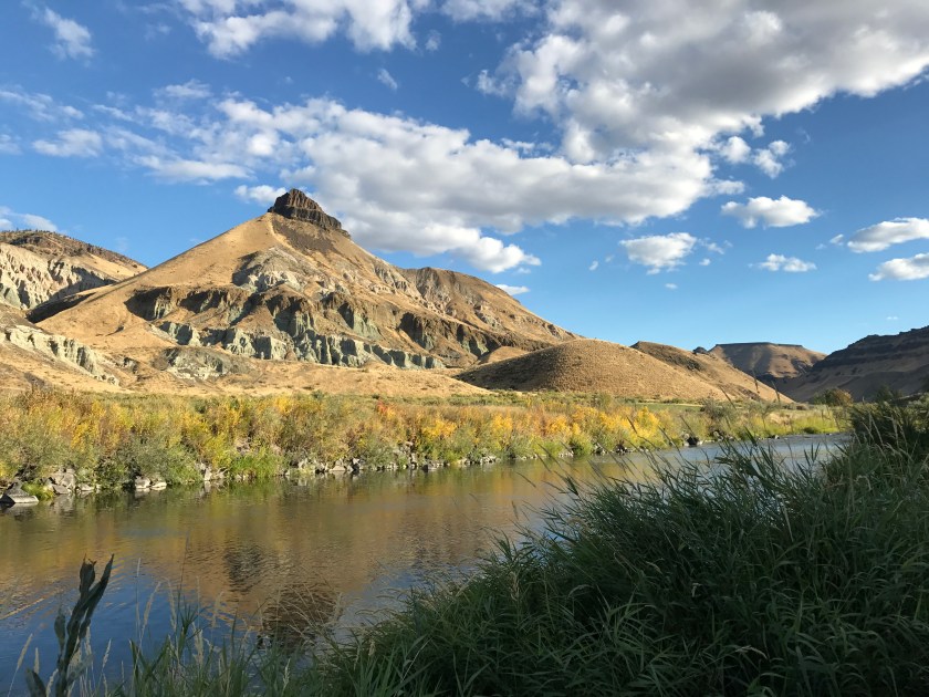
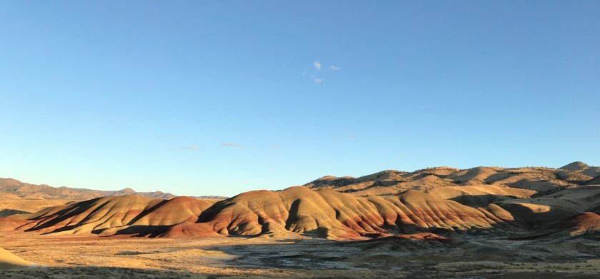
Roo and I proceeded on, passing through the town of Halfway and Baker City. From Baker City, we hit Rte 7 and then Rte 26 and experienced easy driving with exceptional views. Signs for the John Day Fossil Beds and Painted Hills caught my eye and I diverted off to check them out and was not disappointed!
A relic of the past at the historic Cant Ranch.Along the John Day RiverThe Painted Hills of Oregon
It was a long day of driving and it was getting dark by the time I found a camping spot in the Ochoco National Forest at the Ochoco Divide Campground.
I hit the road early the morning of 9/27. Roo and I were headed for Tumalo, OR, outside of Bend to spend a few days with friends and to have some issues with Greta worked out. On the way, I decided to check out something called ‘Steins Pillar’ that was called out in the Unique Natural Features section of my Oregon gazetteer. We were treated to a very scenic drive up a valley and then a wonderful hike through pine and juniper forests. Steins Pillar is a stone pillar that reaches 350 feet straight up, towering above the surrounding forest, a reminder of the volcanic activity that created this landscape. Along the hike, I got my first glimpses of the mountains to the west in the Cascade Range.
Steins Pillar from below.
Steins Pillar from above.
Come on, mom! Let’s go!
Cascade Range just peaking above the ridge line.
After the hike, Roo and I pushed on, making a stop in Prineville to have lunch and a brew at the Ochoco Brewing Company.
We arrived at my friend’s in Tumalo, OR that afternoon. Tumalo rocks! It’s an adorable small town, just outside of Bend, OR… country living with the convenience and amenities of Bend a quick drive away.
It was SO great to be with friends and I had a FUN few days. Good times, good conversations, good laughs, good food! And Roo was in heaven. She was a happy happy camper, collapsing in content exhaustion at the end of each day.
Roo (just turned 3), Boone (just turned 10) and Raven (the baby at 2.5). Note that Boone has the most amazing tuft of hair that protrudes from the top of his head, like Alfalfa from the Little Rascals.
The recreational options in the Bend area of Oregon are outstanding. Days often started with a quick walk with the dogs on BLM land, through sage brush and gnarly old Junipers. One day I tagged along on a quick fly fishing outing and enjoyed an hour chilling out along the banks of the Crooked River.
The Crooked River
On Sunday, 10/1, we headed up to the Mt. Bachelor area to do some mushroom hunting. The mushroom hunting was a bust but we had a lovely little hike to Fall River Falls and lunch along river where the water runs ‘clear as gin’. (I have to credit Corky for that great description. I love it.)
Fall River Falls
Now I’m off to explore the SE corner of Oregon and the Malheur Wildlife Refuge and the Steen Mountains. Stay tuned!
I departed the Methow Valley on 9/20 and based on a tip from a friend, headed to check out the town of Tieton, WA. It’s become a hub of artistic activity and I was curious to check out the scene. But not much goes on in Tieton midweek apparently and I found a very tiny, quiet town. I pushed on and found camping off Route 12 outside of Naches, WA at Windy Point Campground and Roo and I passed an uneventful evening along the Naches River.
Windy Point Campground along the Naches River.
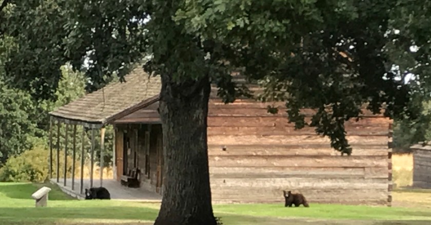
9/21 I pushed off to check out Fort Simcoe. I’m so glad I took the time. Amazing scenery and remarkably well preserved historic buildings with wild ponies and bears roaming the grounds.
Wild pony roaming the grounds of Fort Simcoe
A sow and her cub roaming around Fort Simcoe
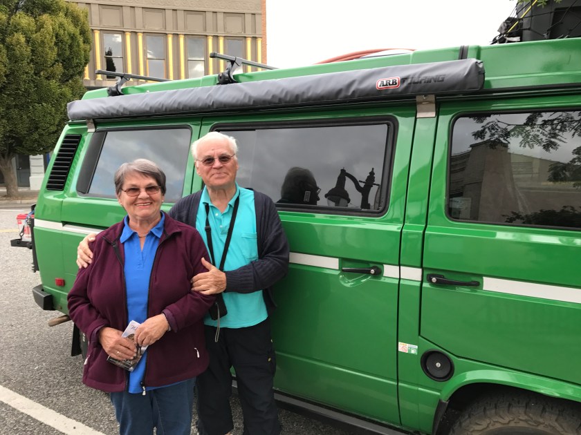
From Fort Simcoe, I set off for Waitsburg, WA and another night of camping at the Lewis and Clark Trail State Park. Waitsburg was adorable but pretty quiet. I very nice German couple, Klaus and Helga, came over to complement Greta and when they found out I had spent some time in Germany, we spent about a 1/2 hour speaking in broken German swapping travel stories. They were SO excited about my road trip adventure. ‘Ganz Toll! Ganz Toll!’ (So cool! So cool!) exclaimed Klaus over and over.
Klaus and Helga in Waitsburg, WA
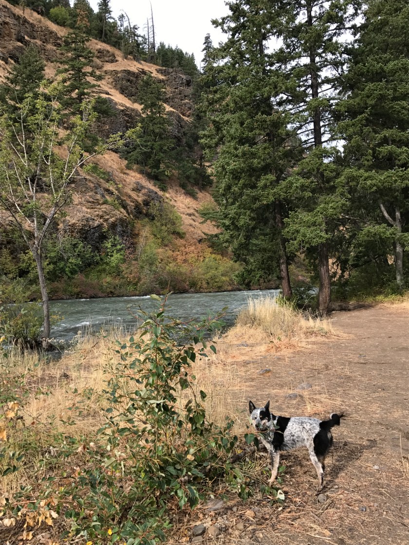
After a beer and burger at the Laht Neppur Brewing Co., Roo and I found a nice little campsite at the state park and settled in and had a nice quiet evening. We hiked around a bit and played along the banks of the Touchet River and I marveled at the gigantic pines scattered throughout the campground.
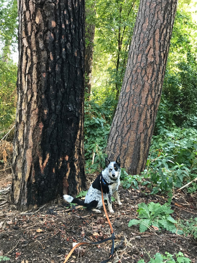
Roo in front of big old pine trees.
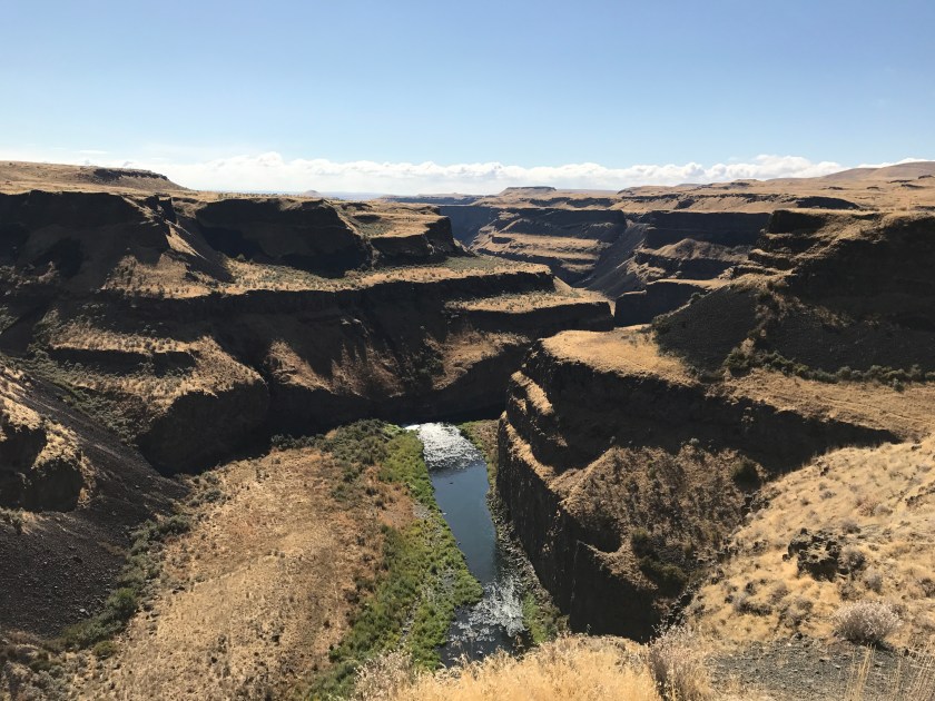
9/22 Roo and I pushed off towards the Clarkston, WA/Lewiston, OR area. Along the way, I saw a sign for Palouse Falls and decided to follow my nose. So glad I did. The scenery was spectacular.
Palouse Falls – apparently the official waterfall of the state of Washington.View from Palouse Falls State Park
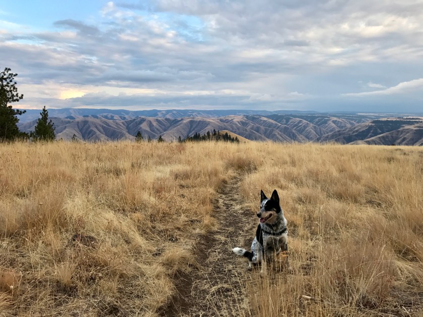
I passed through Clarkston and Lewiston and pushed onto Field Springs State Park, outside of Anatone, WA along Rte 129. It was SO quiet and Roo and I enjoyed a great hike that evening and had the trails all to ourselves. I was blown away by the vistas.
View from Puffer Butte at Field Springs State Park.
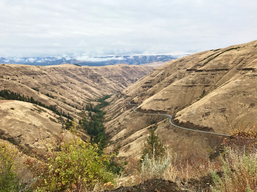
9/23 Roo and I headed towards Jospeh, OR. The stretch of Rte 129/Rte 3 that I drove that morning was AMAZING, windy with spectacular vistas. The road essentially follows a section of the historic New Perce Trail. Numerous historic markers along the route are reminders of the disgraceful treatment of Native Americans.
Rte 129/Rte 3 in SE WA, NE OR.
Joseph Canyon Overlook
Rolled into Joseph, OR and I was smitten! Adorable hub of art and culture with Lake Wallowa and the Wallowa Mountains as its backdrop. My kind of town!
Roo and I camped at Lake Wallowa and hiked around during the day. We found Kokanee salmon spawning in the river. What a cool surprise!
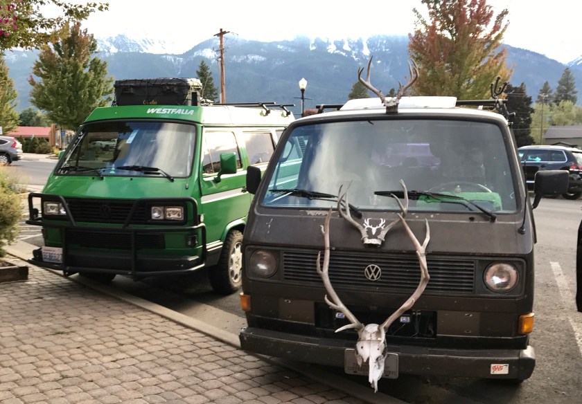
Enjoyed a couple of yummy beers at Embers Brewhouse and ran into a fellow vanagon owner.
Nice racks!
And now it’s the morning of 9/24 and Roo and I are headed out Rte 39 into the Eagle Cap Wilderness to see if we can find a campsite along the Imnaha River. More updates in a few days, once we’re back in internet and cell phone range.
I was toast after the Vancouver Island trip and when Greta went back into the shop to have her coolant issue worked on, I happily hunkered down for a few days in Seattle from 8/28 to 9/1 at a friend’s house and caught my breath. I was finding myself a bit burned out of the constant bouncing around, 2 nights here, 1 night there, 3 nights here, 2 nights there, etc, etc. It was great to sleep in the same bed for a few nights, enjoy great espresso within a 2 block radius, and have a hot shower every day. And I was able to get out with my friends for one of the last Duck Dodge sails on Lake Union of the season.
Once Greta was ready to roll, Roo and I headed north again. Our plan was to spend a final night or two with our good friends in Skagit Valley at the spot that had been our home base for the summer and then push off to the Methow Valley for a few days before we started to head south towards Oregon.
So we departed Seattle for the last time (I thought) on 9/1, the Friday before Labor Day weekend. We hadn’t been on I-5 North for more than 20 minutes when all gauges on the dashboard went out. No speedometer, tachometer, engine temperature, gas level, or oil pressure. I found myself driving on feel alone. Not an auspicious start to this leg. I called the garage, and unfortunately Kirk, the owner, was off for the long weekend taking a well needed break and the guys holding down the fort at the shop weren’t sure how to help over the phone. So I made a decision to push on and connect with Kirk after the long weekend.
Roo and I spent a couple of nice relaxing days in Skagit hanging with friends, visiting our favorite spots, and getting prepped to depart the PNW. Greta went in for a detailing and got her first wax job. She looked great and was ready to roll, or so I thought.
On Sunday, 9/3, we pushed out to head up Highway 20, over Washington Pass to the town of Winthrop, WA. I was excited to take Greta up and over Washington Pass. It’s a long, steady climb, windy at times, and it would be a good way to test Greta’s mettle.
I expected Greta to get poky on the steeper of the inclines. Kirk had told me to expect as much so I was not initially concerned when she was unable to do more than 55 mph on some of the steeper inclines. But she seemed a little more sluggish than I had anticipated. I hadn’t expected her to struggle to keep speed up quite so much. And I could feel the engine fan kicking on a lot. I suspected she was running hot and overheating but I couldn’t tell for sure since all gauges were out.
I saw some traffic coming up behind me fast so I pulled off into a pull out for a minute to let the line of cars backing up behind me pass.
That’s when things started going bad. As I sat there idling, waiting for traffic to pass, the engine quit. I tried to restart her and she wouldn’t turn over. I got out, circled the van a few times, smelling and looking for anything that seemed off. I waited 5 minutes and tried again. No luck on the first try but when I switched over to the auxiliary batteries she started. But I found when I switched off the auxiliary batteries, the engine struggled again and quit.
Shit! What to do? I was out of cell phone range. Do I try to push on and limp her up and over the pass? Do I put out an SOS sign up and try to get a passing vehicle stop and help me contact roadside assistance? I was just a few miles from cresting the pass and I decided to see if I could limp her up and over.
She made it over but barely. She quit a total of 3 times trying to make it over and when we hit the crest of the pass, she was chugging and struggling. I was praying like crazy to the auto gods to just please please let me make it. A long line of cars had stacked up behind me, and I’m sure their drivers were cursing me and my slow ass VW van.
As we started heading down hill, Greta mellowed out. I could tell she still wasn’t 100% percent but she didn’t seem in imminent danger of dying on me. We made it into Mazama and cell phone range. I turned Greta off to give her a break for a bit and waited for friends to show up. As I sat there, I was feeling pretty crappy and dismayed. Heck, how was I going to make it through a year long road trip if Greta couldn’t handle Washington Pass? It’s not that difficult of a mountain pass. If Washington Pass was an issue, how was she ever going to survive the Colorado Rockies?
My friends arrived and as I followed them from Mazama back to their house, she died for the fourth time on the side of the road in Winthrop after having just driven about 15 miles of easy highway. Something was way off. I figured out that if I kept the power turned completely to the auxiliary batteries, she seemed to be ok. So I turned the switch over the auxiliary batteries made it the last several miles to my friends place on auxiliary battery power.
It had been a long and stressful day. I felt completely deflated. I was supposed to be launching off, out of the Pacific Northwest and Greta hadn’t completed a 300 mile journey without major issues.
I felt even worse in the morning when I couldn’t get the van to start at ALL, regardless if I had power turned to the auxiliary batteries or not. She was dead.
Since it was Labor Day and businesses were closed there was really nothing I could do but wait. I was feeling really upset. I started to despair and feel like the unluckiest person and that everything was falling apart. But then I calmed down and started to take inventory. Ok, so I’m stuck in the Methow Valley. Is that so bad? No, not really… if I’m going to be stuck anywhere I can’t really think of a better place to be stuck. Do I really have anywhere I need to be within a particular time frame? No, not really. And in the grand scheme of things in the world, this is not the worst thing. The news was filled with reports of Hurricane Harvey, North Korea’s nuclear tests, and the forest fires raging through out the west. That put stuff in perspective and I spent the remainder of Labor Day weekend trying not to fret while hiking, playing with dogs and catching up with good friends.
On Tuesday, 9/5, I connected with Kirk at North-Westy who had done the build out of the van. As I hoped, Kirk did not let me down. Kirk said he would drive out in a couple of days to figure out what the issue was all about and get Greta back up and running.
For the next few days I couldn’t really do anything except take walks with the dogs and hang out with good friends. And in hindsight, this time was a gift. I was forced to stop and take inventory and just let go and be ok with where I was at at that point in time.
The fire activity in the Pacific Northwest was causing ash to fall from the sky and smoke to obscure views and I think I had to work a little bit harder to stay positive when everything around me looked sort of ominous and somber.
Ash collecting on Greta.The eerie reddish sun that gave the landscape an ominous feel.
While I was hanging out, waiting for Kirk to arrive to save the day, my friend gave me ‘The Surrender Experiment: My Journey Into Life’s Perction” by Michael A. Singer to read. It couldn’t have been more timely. The book essentially is the story of how all of these wonderful things happened in Michael’s life when he stopped trying to control everything and embraced what the universe brought his way.
While sitting around waiting, I noodled on what the universe had brought my way and over the next couple of days I came around to feeling pretty lucky vs. unlucky. The Methow Valley is one of the most beautiful places I’ve travelled and a place I’ve dreamed of calling home many a times. What a great place to get ‘stuck’. And if these issues with Greta had happened during the Vancouver Island trip with my mom along for the ride that would have been so much worse. And my friends in the Methow are two of the most solid, grounded individuals I know and I couldn’t have had better sounding boards to turn towards during this moment of personal crisis. And my mechanic was making the drive out in a couple of days to right the ship. How fortunate to have a committed person in my corner.
Kirk came out on Friday, 9/8 and identified the root causes of the problem: a bad connection to the alternator and something drawing battery power that shouldn’t be, completely depleting the main battery.
Kirk, owner of North-Westy.
The alternator connection could be fixed on site but what was drawing down the battery was unclear and Greta needed to go back to the shop for further troubleshooting. He replaced the dead main battery with a brand new battery and that got Greta steady enough for me to plan on driving her back to the garage in Renton the following Monday.
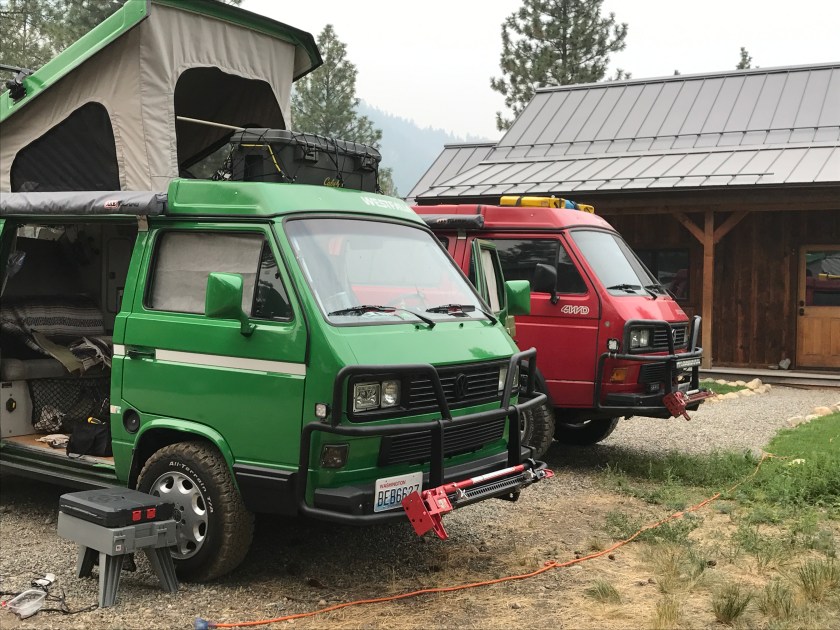
Kirk’s Syncro 16 next to Greta.
That gave me another 2 days to chill out in the Methow. Greta was running again and I spent the weekend driving around the Methow Valley, marveling at how freaking beautiful it is.
Pearrygin Lake State Park
I also hit some of my favorite places, including Hank’s Grocery in Twisp that has the best freezer section ever! Where else can you contemplate what kind of frozen potatoes you’re in the mood for while a water buffalo hovers above your head? Or have a Hyena stand witness to your choice of hand pie flavor?
Hanks Grocery in Twisp, WA. The BEST freezer section EVER!
On Monday, 9/11, with much trepidation I headed out in Greta, bound for Seattle and the garage to hopefully have the electrical issue resolved for good. Greta charged up and over Blewett Pass and Snoqualmie Pass without issue and she got back to the shop just fine. I spent another few days hunkered down at a friends house in Seattle, catching up on laundry and squeezing in as many chiropractic appointments as was possible.
A few days later Greta was ready to roll. The electrical issue was resolved and the van had a thorough going over to make sure all was tight and right. On Friday, 9/15 we departed Seattle again and headed out Highway 2, over Stevens Pass, to the Lake Wenatchee area. Greta felt GREAT! She devoured Stevens Pass without any issues.
We landed at Glacier View Campground on the SE side of Lake Wenatchee. Hardly anyone around and we had a beautiful view from our lakeside campsite.
View from Glacier View campground.
The next day we set off to explore the town of Plain, WA which ended up being even tinier than I had anticipated. Not really a town so much as a stretch of road with a cafe and grocery/coffee shop.
After breakfast at the only breakfast joint around, I headed out rte 207, along the north side of Lake Wenatchee, down a gravelly, dusty forest service road to White River Falls. Roo and I had a GREAT day and night, exploring along the river banks and enjoying the peaceful setting.
White River Falls
White River
The following morning, Sunday, 9/17, I packed up camp and prepared to push on and return to the Methow Valley. But before hitting the road, on a tip from a passing traveler, I drove a little further up the road and checked out the upper falls and hiked a bit. I stumbled upon a gigantic Western Red Cedar that took my breath away. It had to be 20 ft across at the base and had clearly weathered many a storm.
White River Falls
Giant Western Red Cedar
Roo and I took our time making the drive from Lake Wenatchee to the Methow Valley and stopped along Rte 97, along the Columbia River, to romp on the river bank.
Columbia River along Rte 97.
Our return to the Methow Valley went without a hitch. Roo and I spent 9/17 – 9/20 hiking and biking and driving around the valley and having a couple more days to visit with friends.
Old homesteadPigs in a pasture. Praise the Lard!Chaco and Sabe
On 9/20 we pushed off from the Methow Valley, heading south towards Oregon without a very well planned route. More on that leg to come in a later road report post.
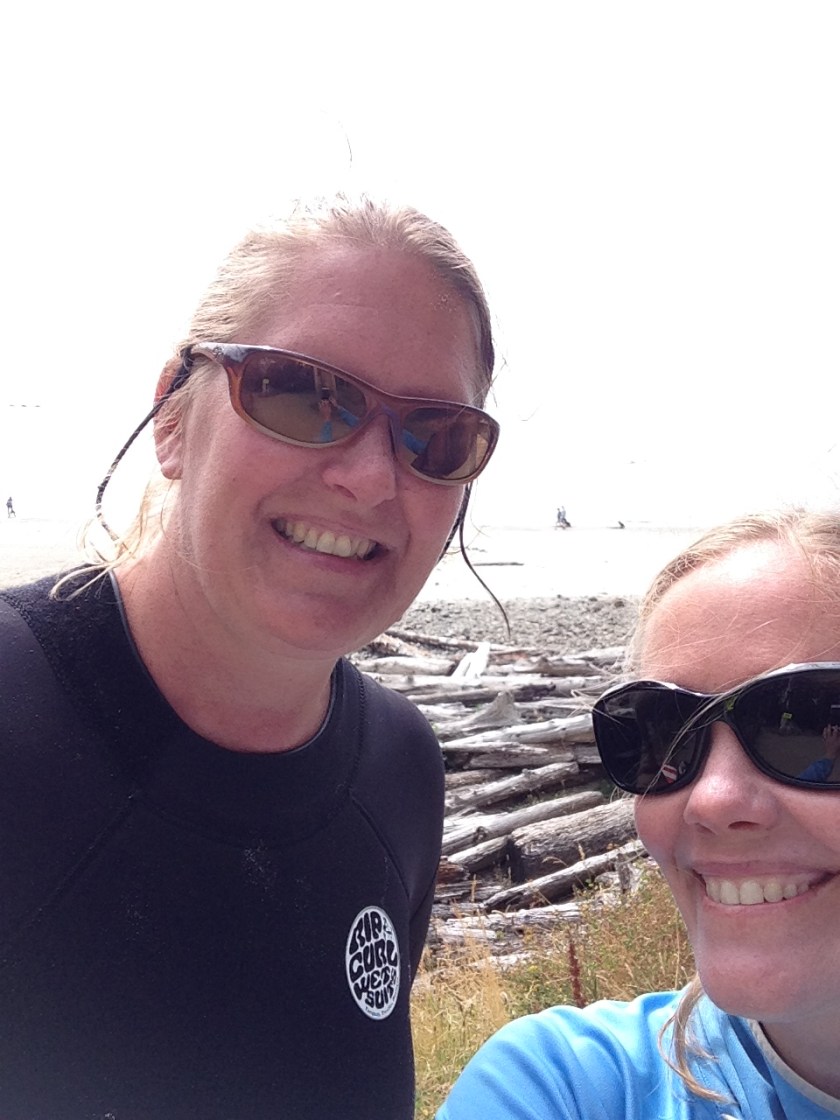
From 8/12 to 8/15 I road tripped down to the Oregon Coast from Seattle and back. Along for the ride was my friend, Carey, the first friend to act as co-pilot and the first human Roo had to contend with for shot gun.
Carey’s neighbor’s cat, Oreo seemed very interested in joining the road trip.
We stayed at my friend Fran’s super sweet, cozy cabin just outside of Manzanita. On the ride down, we stopped at Astoria, OR to check out the scene and grabbed a bite at Fort George Brewery. Dug the scene in Astoria, OR. Hope to return in September to take a deeper dive and see if it deserves to be on the list of possible places to land permanently after road tripping comes to a close.
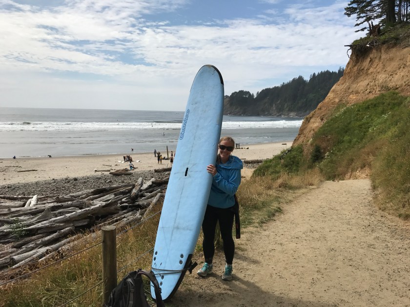
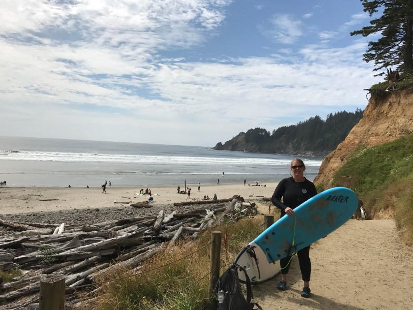
Sunday morning we drove into Cannon Beach to get lattes at the Sleepy Monk coffee house (YUM! the long line was worth the wait) and rent some wetsuits and a surfboard.
For the next 2 days, we boogie boarded and surfed at Short Sands in Oswald State Park, one of the best beaches for beginner surfers as well as top notch people watching. The beach is reached by taking a short trail thru old growth forest that winds along a stream. The stream lets out into a half moon bay. Once you arrive at the beach you’re treated to the ‘scene’, made up of surfers and boogie boarders of all shapes and sizes, kids and adults romping in the ocean and dogs happily running about getting into the action wherever possible. It’s a circus and a HOOT.
Carey rocked it with the surf board, caught a couple of waves, and earned ‘stud’ status for carrying that big ass board up and down to the trail to the beach 2 days in a row.
I stuck to the boogie board (aka the ‘Beater’) and was thoroughly humbled. Swallowed a lot of salty water, got a couple of full on face shots and got tossed around a few times. Also got a few good rides and couldn’t have been happier. Playing in the surf was cathartic!
Relaxing in the wood fired sauna and around the campfire back at the cabin rounded out our evenings and I don’t think Carey or I were really ready to leave when 8/15 rolled around. Roo certainly didn’t want to leave. She LOVES running on the Oregon Beaches.
On our way out of town we hit Sea Level in Cannon Beach for delicious lattes and baked goods and I had my first kouign amann pastry. Holy hell they were good. Don’t miss Sea Level if you’re a coffee and pastry snob like me.


 Carey’s neighbor’s cat, Oreo seemed very interested in joining the road trip.
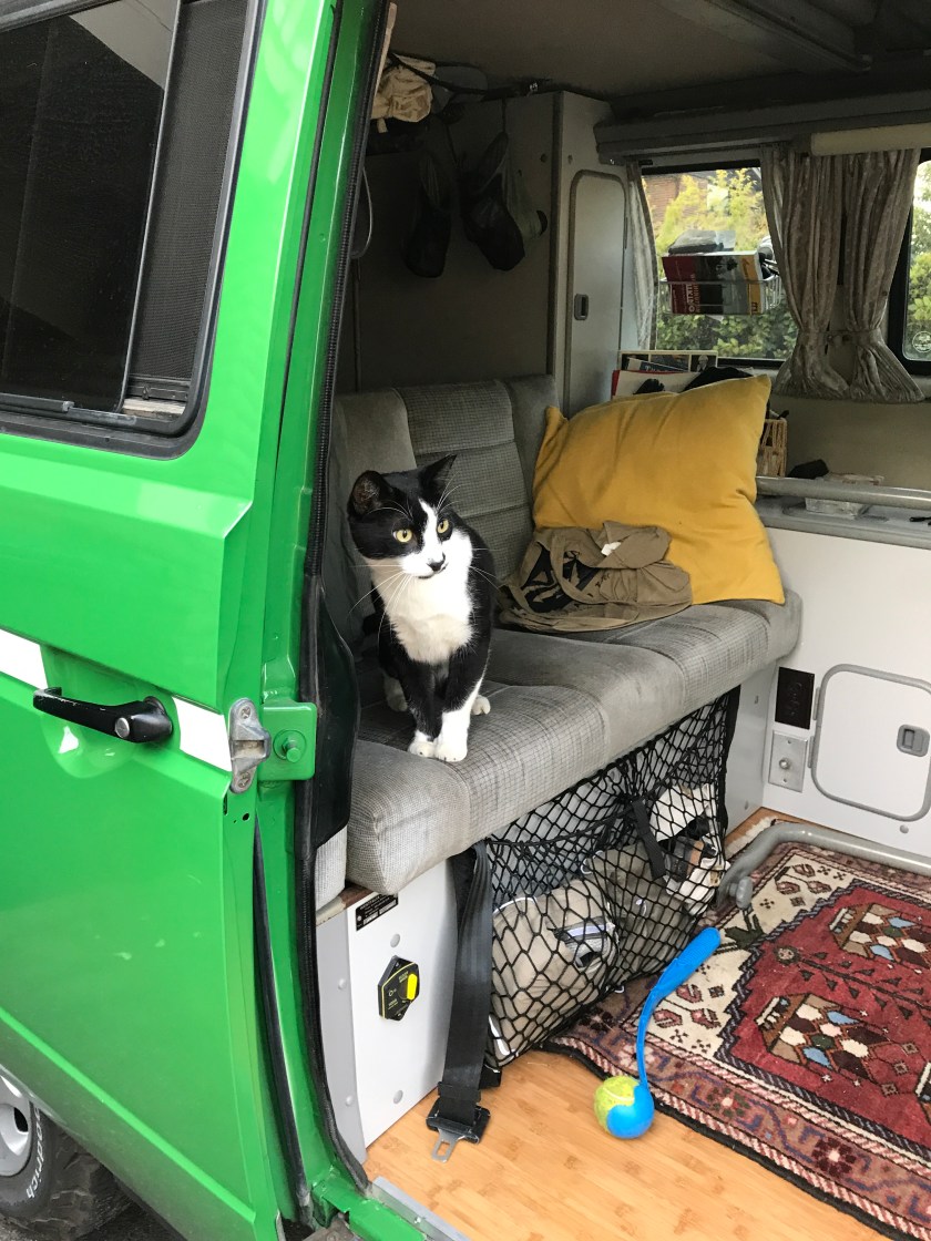
 Relaxing in the wood fired sauna and around the campfire back at the cabin rounded out our evenings and I don’t think Carey or I were really ready to leave when 8/15 rolled around. Roo certainly didn’t want to leave. She LOVES running on the Oregon Beaches.